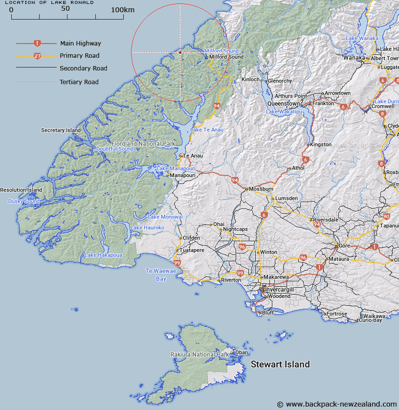
Map showing location of Lake Ronald


LINZ description: Approximately one and a half miles inland from Transit Beach, near Milford Sound. Mitre Peak Survey District.
Latitude: -44.634128
Longitude: 167.714862
Northing: 5044088.8
Easting: 1180800
Land District: Southland
Feat Type: Lake


Scroll down to see a more detailed road map and below that a topographical map showing the location of Lake Ronald. The road map has been supplied by openstreetmap and the topographical map of Lake Ronald has been supplied by Land Information New Zealand (LINZ).

Yes you can use the top static map for you school/university project or personal website with a link back. Contact me for any commercial use.

Lake Ronald Map New Zealand


New Zealand places in our database
[ A ] [ B ] [ C ] [ D ] [ E ] [ F ] [ G ] [ H ] [ I ] [ J ] [ K ] [ L ] [ M ] [ N ] [ O ] [ P ] [ Q ] [ R ] [ S ] [ T ] [ U ] [ V ] [ W ] [ X ] [ Y ] [ Z ]


Closest 20 Lakes to Lake Ronald

Lake Ronald ( 0km )   Lake Moreton ( 6.32km )   Lake Morton ( 6.32km )   Lake Brown ( 13.97km )   Lake Ada ( 13.99km )   Lake Dale ( 16.3km )   Lake Quill ( 19.38km )   Pukutahi Lake ( 19.82km )   Lake Mintaro ( 20.05km )   Lake Never-never ( 20.75km )   Mirror Lake ( 21.1km )   Lake Grave ( 21.87km )   Buttercup Lake ( 23.93km )   Lake Iceberg ( 24.1km )   Swan Mere ( 24.11km )   Lake Turner ( 25.37km )   Lake Iceberg ( 25.37km )   Lake Truth ( 26.47km )   Lake Sumor ( 26.54km )   Black Lake ( 26.85km )   Hidden Lake ( 26.89km )   Lake Adelaide ( 27.51km )   Lake Thompson ( 27.83km )   Lake Agnes ( 28.13km )   Lake Bernard ( 28.26km )   Lake Brownlee ( 28.62km )   Lake Mariana ( 29.4km )   Rainbow Lake ( 29.88km )   Lake Marianette ( 30.17km )   Lake Erskine ( 31.71km )   Lake Marian ( 33.02km )   Lake Beddoes ( 33.1km )   Lake McKerrow ( 34.02km )   Lake McKerrow/Whakatipu Waitai ( 34.02km )   Lake Ross ( 34.31km )   Lake Mantle ( 34.35km )   Lake Hyslop ( 35.29km )   McKenzie Lagoon ( 36.35km )   Lake Speden ( 36.78km )   Lake Alabaster/W?w?hi Waka ( 37.31km )