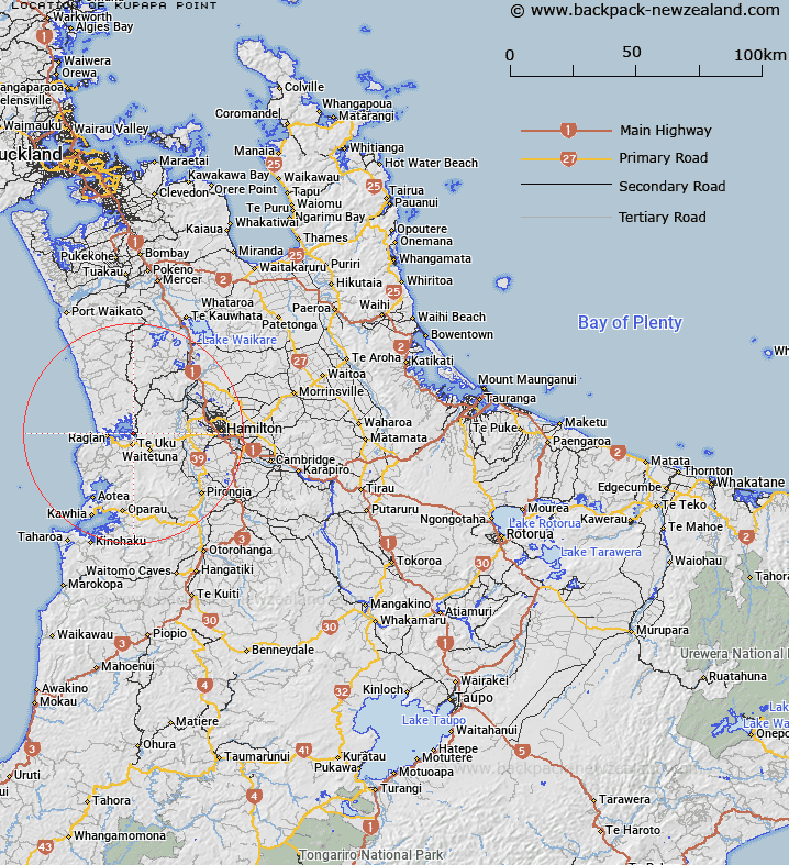
Map showing location of Kupapa Point


LINZ description: Point on the western side at the mouth of the Waitetuna River which enters Raglan harbour, 2.75km North of Pukepuketetai hill [Trig. 39 (Geodetic Code A3YE)]. Block III Karioi Survey District.
Latitude: -37.791595
Longitude: 174.963779
Northing: 5815491.3
Easting: 1772909.8
Land District: South Auckland
Feat Type: Point


Scroll down to see a more detailed road map and below that a topographical map showing the location of Kupapa Point. The road map has been supplied by openstreetmap and the topographical map of Kupapa Point has been supplied by Land Information New Zealand (LINZ).

Yes you can use the top static map for you school/university project or personal website with a link back. Contact me for any commercial use.

Kupapa Point Map New Zealand


New Zealand places in our database
[ A ] [ B ] [ C ] [ D ] [ E ] [ F ] [ G ] [ H ] [ I ] [ J ] [ K ] [ L ] [ M ] [ N ] [ O ] [ P ] [ Q ] [ R ] [ S ] [ T ] [ U ] [ V ] [ W ] [ X ] [ Y ] [ Z ]


Closest 20 Points to Kupapa Point

Paroa Point ( 2.05km )   The Finger ( 2.27km )   Pirere Point ( 2.88km )   Hawea Point ( 3.63km )   Tarangaiwi Point ( 3.96km )   Te Puna Point ( 3.96km )   Paritata Point ( 4.17km )   Hauraki Point ( 4.74km )   Matanawe Point ( 5.45km )   Motukokako Point ( 5.7km )   Ann Point ( 7.39km )   Tokatoka Point ( 7.58km )   Horongarara Point ( 8.16km )   Putoetoe Point ( 8.56km )   Joys Point ( 8.74km )   Marotaka Point ( 8.81km )   Rangitoto Point ( 10.68km )   Te Kaha Point (Mussel Rocks) ( 11.66km )   Te Hara Point ( 13.65km )   Woody Head ( 19.91km )   Kairere Point ( 19.97km )   Ruaaweke Point ( 19.99km )   Mowhiti Point ( 20.35km )   Tikitiki Point ( 20.4km )   Te Heru Point ( 20.63km )   Uruwera Point ( 20.88km )   Papanui Point ( 20.97km )   Te Pahi Point ( 21.18km )   Te Ruatangata Point ( 21.26km )   Piritoka Point ( 21.71km )   Mutawha Point ( 21.71km )   Matawha Point ( 21.71km )   Kauaakoara Point ( 21.76km )   Te Ruangarara Point ( 22.51km )   Te Arakanohi Point ( 22.85km )   Te Wharemataiti Point ( 23.18km )   Ohau Point ( 23.76km )   Ruakoiro Point ( 24.34km )   Rauiri Head ( 24.44km )   Te Ruakotare Point ( 24.96km )