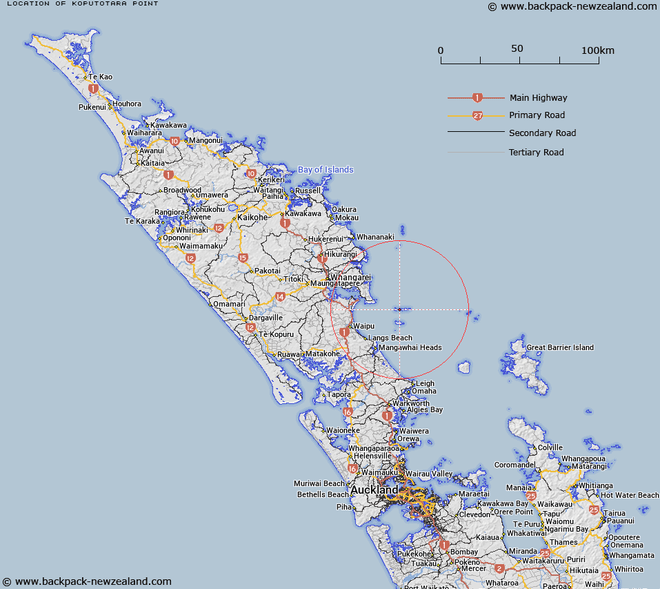
Map showing location of Koputotara Point


LINZ description: Point on the coast at the western headland of South Cove, Lady Alice Island, in the Hen and Chickens Islands.
Latitude: -35.89365
Longitude: 174.722498
Northing: 6026476.9
Easting: 1755460.2
Land District: North Auckland
Feat Type: Point


Scroll down to see a more detailed road map and below that a topographical map showing the location of Koputotara Point. The road map has been supplied by openstreetmap and the topographical map of Koputotara Point has been supplied by Land Information New Zealand (LINZ).

Yes you can use the top static map for you school/university project or personal website with a link back. Contact me for any commercial use.

Koputotara Point Map New Zealand


New Zealand places in our database
[ A ] [ B ] [ C ] [ D ] [ E ] [ F ] [ G ] [ H ] [ I ] [ J ] [ K ] [ L ] [ M ] [ N ] [ O ] [ P ] [ Q ] [ R ] [ S ] [ T ] [ U ] [ V ] [ W ] [ X ] [ Y ] [ Z ]


Closest 20 Points to Koputotara Point

Muritai Point ( 1.01km )   Busby Point ( 3.36km )   McKay Point ( 3.68km )   Mackay Point ( 3.78km )   Coppermine Point ( 4.07km )   Holman Point ( 5.13km )   Lighthouse Point ( 5.51km )   Bream Head ( 12.61km )   Busby Head ( 17.63km )   Home Point ( 18.43km )   Paepae-o-T? / Bream Tail ( 20.78km )   Bream Tail ( 20.78km )   Lort Point ( 21km )   Darch Point ( 22.23km )   Taiharuru Head ( 24.12km )   One Tree Point ( 25.52km )   Reserve Point ( 26.02km )   Ngamatengau Point ( 26.05km )   Kirikiri Point ( 26.15km )   Te Whangai Head ( 26.85km )   Manganese Point ( 27.31km )   Mangatawa Point ( 27.42km )   Solomons Point ( 27.89km )   Eyres Point ( 30.41km )   Te Arai Point ( 30.75km )   Mangawhati Point ( 32.22km )   Kumi Point ( 32.64km )   Whau Point ( 33.08km )   Knight Point ( 33.89km )   Hewlett Point ( 34.05km )   Stevens Point ( 34.52km )   Tutukaka Head (South Gable) ( 35.09km )   Kaiwaka Point ( 35.82km )   Onemama Point ( 36.3km )   Middle Gable ( 36.5km )   Tapu Point ( 37.54km )   North Gable ( 37.68km )   Okakari Point ( 41.07km )   Rangitapu Point ( 41.67km )   Rokoaweke Point ( 42.15km )