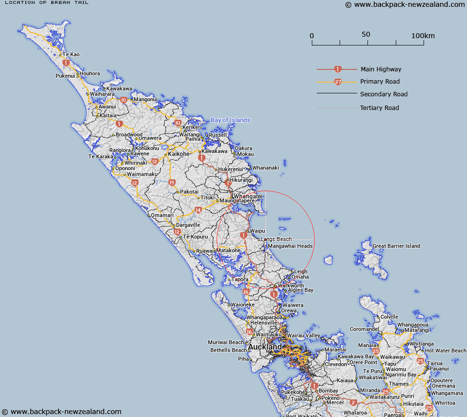
Map showing location of Bream Tail


LINZ description: A coastal headland located approximately 5km north of Mangawhai Heads. Feature shown on: NZMS260 R08; NZTopo50 AY31, GR 431 098.
Latitude: -36.045869
Longitude: 174.588597
Northing: 6009796.4
Easting: 1743099.2
Land District: North Auckland
Feat Type: Point


Scroll down to see a more detailed road map and below that a topographical map showing the location of Bream Tail. The road map has been supplied by openstreetmap and the topographical map of Bream Tail has been supplied by Land Information New Zealand (LINZ).

Yes you can use the top static map for you school/university project or personal website with a link back. Contact me for any commercial use.

Bream Tail Map New Zealand


New Zealand places in our database
[ A ] [ B ] [ C ] [ D ] [ E ] [ F ] [ G ] [ H ] [ I ] [ J ] [ K ] [ L ] [ M ] [ N ] [ O ] [ P ] [ Q ] [ R ] [ S ] [ T ] [ U ] [ V ] [ W ] [ X ] [ Y ] [ Z ]


Closest 20 Points to Bream Tail

Bream Tail ( 0km )   Paepae-o-T? / Bream Tail ( 0km )   Eyres Point ( 13.97km )   Te Arai Point ( 14.41km )   Koputotara Point ( 20.78km )   Busby Head ( 21.16km )   Bream Head ( 21.39km )   Muritai Point ( 21.62km )   Home Point ( 22.47km )   Busby Point ( 22.87km )   Coppermine Point ( 23.35km )   McKay Point ( 23.36km )   Mackay Point ( 23.54km )   Holman Point ( 24.43km )   Lighthouse Point ( 24.94km )   Lort Point ( 25.1km )   Paparoa Point ( 26.42km )   Darch Point ( 26.59km )   One Tree Point ( 27.94km )   Okakari Point ( 28.85km )   Te Hoanga Point ( 29.48km )   Reserve Point ( 30.19km )   Manganese Point ( 30.78km )   Te Whakarapa Point ( 31.11km )   Ngaupiko Point ( 31.61km )   Kirikiri Point ( 31.95km )   Whakapirau/Rocky Point ( 32km )   Rocky Point ( 32km )   Otara Head ( 32.07km )   Mangawhati Point ( 32.11km )   Solomons Point ( 32.27km )   Gittos Point ( 32.37km )   Mangatawa Point ( 32.92km )   Huarua Point ( 32.94km )   Te Kopua Point ( 33.07km )   Cape Rodney ( 33.21km )   Puriri Point ( 33.6km )   Hewlett Point ( 33.65km )   Page Point ( 33.67km )   Ngamotu Point ( 33.68km )