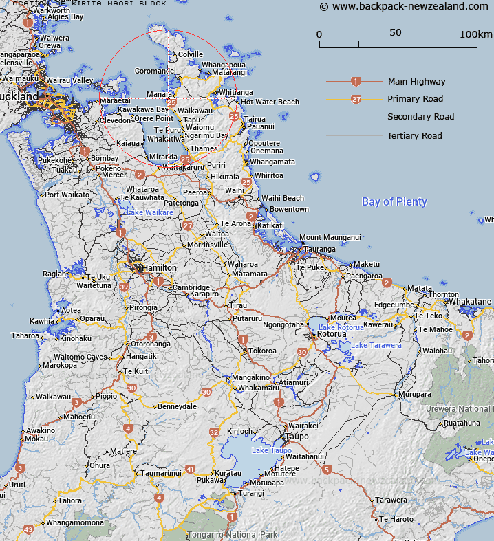
Map showing location of Kirita Maori Block


LINZ description: Māori Block South of Manaia Harbour, Coromandel Peninsula. As shown on South Auckland Plan ML 2729. Coromandel & Hastings Survey Districts.
Latitude: -36.867372
Longitude: 175.435339
Northing: 5917071.4
Easting: 1817081.1
Land District: South Auckland
Feat Type: Appellation


Scroll down to see a more detailed road map and below that a topographical map showing the location of Kirita Maori Block. The road map has been supplied by openstreetmap and the topographical map of Kirita Maori Block has been supplied by Land Information New Zealand (LINZ).

Yes you can use the top static map for you school/university project or personal website with a link back. Contact me for any commercial use.

Kirita Maori Block Map New Zealand


New Zealand places in our database
[ A ] [ B ] [ C ] [ D ] [ E ] [ F ] [ G ] [ H ] [ I ] [ J ] [ K ] [ L ] [ M ] [ N ] [ O ] [ P ] [ Q ] [ R ] [ S ] [ T ] [ U ] [ V ] [ W ] [ X ] [ Y ] [ Z ]


Closest 20 Appellations to Kirita Maori Block

Mawitipana Maori Block ( 35.69km )   Mawhitipana Maori Block ( 35.69km )   Otamaurunganu Block ( 64.57km )   Otamaurunganui Block ( 64.57km )   Waitakere Block ( 86.04km )   Waitakerei Block ( 86.04km )   Mangawhai Parish ( 114.06km )   Mangawai Parish ( 114.06km )   Waire Settlement ( 132.98km )   Waiari Settlement ( 132.98km )   Awaateatua Survey District ( 162.51km )   Mangapehi ( 183.08km )   Waikare Block ( 201.78km )   Waiotahe Parish ( 204.07km )   Waiotahi Parish ( 204.07km )   Te Uwhi Block ( 209.2km )   Waioeka Parish ( 212.57km )   Wheao Survey District ( 214.74km )   Weao ( 214.74km )   Ngatiira ( 219.55km )   Ngatira ( 219.55km )   Waiaua East Survey District ( 231.77km )   Waiawa East ( 231.77km )   Whakapaupakihi ( 241.3km )   Whakapaupakahi ( 241.3km )   Tuatawhata ( 243.53km )   Tuwatawata ( 243.53km )   Tuawatawata ( 243.53km )   Matengareka Block ( 246.24km )   Matangareka Block ( 246.24km )   Maungaparahi Block ( 253.49km )   Mangaparahi Block ( 253.49km )   Waiorongomai Block ( 259.13km )   Orewha ( 261.57km )   Oriwha ( 261.57km )   Maikukutea ( 263.22km )   Meakokutea ( 263.22km )   Matakuhia Block ( 266.84km )   Matakuia Block ( 266.84km )   Whakamarutuna Block ( 267.34km )