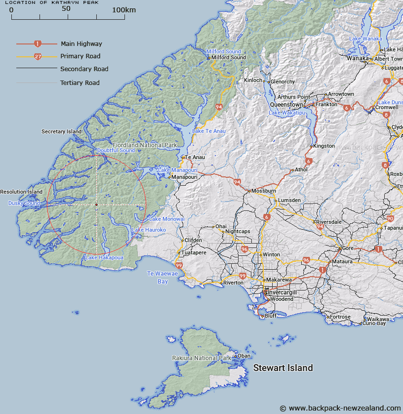
Map showing location of Kathryn Peak


LINZ description: Two miles north of Seaview Peak, between Lake Hauroko and Dusky Sound 4,684 ft
Latitude: -45.768023
Longitude: 167.04948
Northing: 4914481
Easting: 1137338.1
Land District: Southland
Feat Type: Hill


Scroll down to see a more detailed road map and below that a topographical map showing the location of Kathryn Peak. The road map has been supplied by openstreetmap and the topographical map of Kathryn Peak has been supplied by Land Information New Zealand (LINZ).

Yes you can use the top static map for you school/university project or personal website with a link back. Contact me for any commercial use.

Kathryn Peak Map New Zealand


New Zealand places in our database
[ A ] [ B ] [ C ] [ D ] [ E ] [ F ] [ G ] [ H ] [ I ] [ J ] [ K ] [ L ] [ M ] [ N ] [ O ] [ P ] [ Q ] [ R ] [ S ] [ T ] [ U ] [ V ] [ W ] [ X ] [ Y ] [ Z ]


Closest 20 Hills to Kathryn Peak

Sea View Peak ( 2.18km )   Mount Solitary ( 5.68km )   Mount Chisholm ( 10.17km )   Cone Peak ( 10.3km )   Mount Vera ( 10.72km )   End Peak ( 10.95km )   Tamatea Peak ( 12.5km )   Mount Edgecumbe ( 13.18km )   Mount Thompson ( 13.5km )   Mount Reeves ( 14.04km )   Mount McCorley ( 14.32km )   Vincent Peak ( 14.57km )   Perpendicular Peak ( 14.76km )   Mount Fitchett ( 15.39km )   Tripod Hill ( 15.73km )   Mount Pender ( 16.34km )   McDonnell Peak ( 16.87km )   Mount Pember ( 16.92km )   Tussock Peak ( 16.98km )   Mount Puteketeke ( 18.19km )   Aubrey Peak ( 18.27km )   Houseroof Hill ( 18.3km )   Mount Burnett ( 18.63km )   Mount Cusack ( 19.5km )   White Peak ( 19.75km )   Mount Menteath ( 20.27km )   Mount Nantes ( 20.41km )   Mount Ward ( 20.55km )   Mount Bain ( 20.78km )   Heywood Peak ( 21.38km )   Mount Thornton ( 21.41km )   Mount Memphis ( 21.44km )   Mount Noble ( 21.69km )   Needle Peak ( 22.16km )   Pinnacle ( 22.38km )   Caroline Peak ( 22.58km )   Mount Horatio ( 22.63km )   Mount Hodges ( 23.13km )   Mount Watson ( 23.33km )   Mount Crowfoot ( 23.91km )