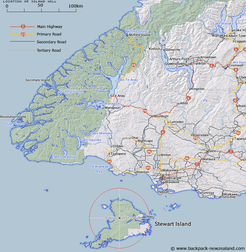
Map showing location of Island Hill


LINZ description: Solitary hill west of Scott Burn. Instead of "Island Hill"
Latitude: -46.913845
Longitude: 167.820468
Northing: 4791374
Easting: 1205626.3
Land District: Southland
Feat Type: Hill


Scroll down to see a more detailed road map and below that a topographical map showing the location of Island Hill. The road map has been supplied by openstreetmap and the topographical map of Island Hill has been supplied by Land Information New Zealand (LINZ).

Yes you can use the top static map for you school/university project or personal website with a link back. Contact me for any commercial use.

Island Hill Map New Zealand


New Zealand places in our database
[ A ] [ B ] [ C ] [ D ] [ E ] [ F ] [ G ] [ H ] [ I ] [ J ] [ K ] [ L ] [ M ] [ N ] [ O ] [ P ] [ Q ] [ R ] [ S ] [ T ] [ U ] [ V ] [ W ] [ X ] [ Y ] [ Z ]


Closest 20 Hills to Island Hill

Big Sandhill ( 2.63km )   Walkers Hill ( 4.7km )   Mount Rakeahua ( 5.59km )   Traills Hill ( 7.52km )   Upper Island Hill ( 9.51km )   Rocky Mountain ( 11.53km )   Benson Peak ( 12.86km )   Bald Hill ( 12.96km )   Adams Hill ( 13.03km )   Table Hill ( 14.07km )   Pryse Peak ( 14.25km )   Doughboy Hill ( 14.46km )   Blaikies Hill ( 15.74km )   The Paps ( 16.79km )   Red Head Peak ( 18.96km )   Little Mount Anglem ( 19.01km )   Kirklands Hill ( 19.15km )   Mount Allen ( 19.19km )   Mount Anglem/Hananui ( 20.61km )   Mount Anglem ( 20.61km )   Granite Knob ( 20.88km )   Lees Knob ( 21.2km )   Magog Peak ( 21.33km )   Observation Rock ( 23.15km )   Garden Mound ( 23.16km )   Peterson Hill ( 23.98km )   Adventure Hill ( 24.01km )   Stony Hill ( 25.12km )   Hielanman ( 35.32km )   Fraser Peaks ( 36.28km )   Gog Peak ( 37.18km )   Bald Cone ( 38.17km )   Smiths Lookout ( 42.07km )   Flat Hill ( 51.52km )   The Bluff/Motup?hue ( 51.58km )   The Bluff ( 51.58km )   Three Sisters ( 53.35km )   Ruahine Hill ( 61.97km )   Pahia Hill ( 66.23km )   Round Hill ( 68.99km )