Map showing location of Horonga o te Kaahu


Latitude: -37.818424
Longitude: 178.374488
Northing: 5800700
Easting: 2073200
Land District: Gisborne
Feat Type: Locality
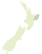

Scroll down to see a more detailed road map and below that a topographical map showing the location of Horonga o te Kaahu. The road map has been supplied by openstreetmap and the topographical map of Horonga o te Kaahu has been supplied by Land Information New Zealand (LINZ).

Yes you can use the top static map for you school/university project or personal website with a link back. Contact me for any commercial use.
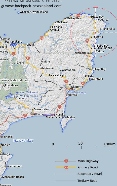
Horonga o te Kaahu Map New Zealand


New Zealand places in our database
[ A ] [ B ] [ C ] [ D ] [ E ] [ F ] [ G ] [ H ] [ I ] [ J ] [ K ] [ L ] [ M ] [ N ] [ O ] [ P ] [ Q ] [ R ] [ S ] [ T ] [ U ] [ V ] [ W ] [ X ] [ Y ] [ Z ]


Closest 20 Localitys to Horonga o te Kaahu

Wairoa ( 1.42km )   Kakariki ( 1.78km )   Waiomatatini ( 2.24km )   Whakawhitira ( 4.17km )   Port Awanui ( 6.39km )   Reporua ( 6.96km )   Maraehara ( 7.91km )   Rangitukia ( 8.49km )   Mahora ( 8.81km )   Rotokautuku ( 9.47km )   Ruatoria ( 9.77km )   Takamore ( 10.73km )   Tuparoa ( 11.31km )   Papawera ( 13.02km )   Whakaangiangi ( 13.26km )   Pohatukura ( 13.82km )   Whakapourangi ( 15.38km )   Awatere ( 15.7km )   Hiruharama ( 15.82km )   Whareponga ( 16.63km )   Pipiwhauraroa ( 18.57km )   Pipiwharauroa ( 18.57km )   Aorangi ( 19.74km )   Te Araroa ( 20.59km )   Kopuaroa ( 20.68km )   Ohineakai ( 21.24km )   Horoera ( 21.46km )   Horowera ( 21.46km )   Tokata ( 21.99km )   Waipiro Bay ( 22.8km )   Takapau ( 23.94km )   Hicks Bay ( 26.3km )   Te Puia Springs ( 26.86km )   Te Waipuna ( 28.26km )   Te Upoko ( 28.63km )   Ihungia ( 30.57km )   Waima ( 32.05km )   Hautanoa ( 32.07km )   Te Puka ( 33.25km )   Potaka ( 33.95km )