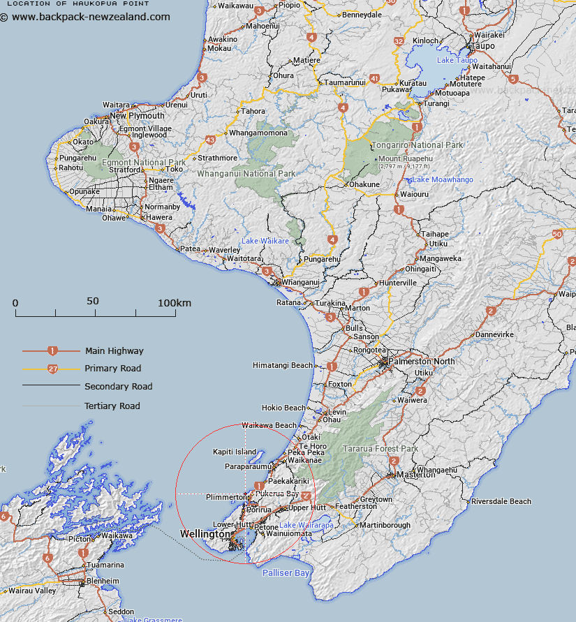
Map showing location of Haukōpua Point
LINZ description: A coastal point between Te Rewarewa Point and Wairaka Point approximately 4 km north northwest of Plimmerton. NZTopo50-BP31 553542.
Latitude: -41.047947
Longitude: 174.849017
Northing: 5454273.4
Easting: 1755396.2
Land District: Wellington
Feat Type: Point
Latitude: -41.047947
Longitude: 174.849017
Northing: 5454273.4
Easting: 1755396.2
Land District: Wellington
Feat Type: Point

Scroll down to see a more detailed road map and below that a topographical map showing the location of Haukōpua Point. The road map has been supplied by openstreetmap and the topographical map of Haukōpua Point has been supplied by Land Information New Zealand (LINZ).
Yes you can use the top static map for you school/university project or personal website with a link back. Contact me for any commercial use.
[ A ] [ B ] [ C ] [ D ] [ E ] [ F ] [ G ] [ H ] [ I ] [ J ] [ K ] [ L ] [ M ] [ N ] [ O ] [ P ] [ Q ] [ R ] [ S ] [ T ] [ U ] [ V ] [ W ] [ X ] [ Y ] [ Z ]