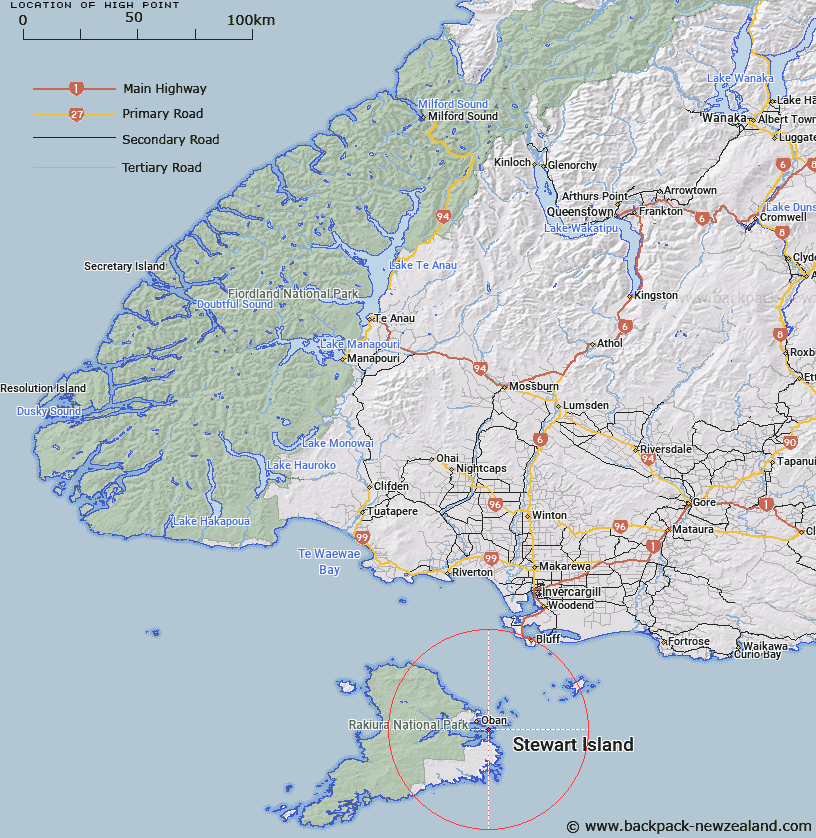
Map showing location of High Point


LINZ description: Point on the northern coast of The Neck, 200m West of Trig. The Neck No 2 (Geodetic Code 1074), Stewart Island. Paterson Survey District.
Latitude: -46.928034
Longitude: 168.174847
Northing: 4791522.3
Easting: 1232701.8
Land District: Southland
Feat Type: Point


Scroll down to see a more detailed road map and below that a topographical map showing the location of High Point. The road map has been supplied by openstreetmap and the topographical map of High Point has been supplied by Land Information New Zealand (LINZ).

Yes you can use the top static map for you school/university project or personal website with a link back. Contact me for any commercial use.

High Point Map New Zealand


New Zealand places in our database
[ A ] [ B ] [ C ] [ D ] [ E ] [ F ] [ G ] [ H ] [ I ] [ J ] [ K ] [ L ] [ M ] [ N ] [ O ] [ P ] [ Q ] [ R ] [ S ] [ T ] [ U ] [ V ] [ W ] [ X ] [ Y ] [ Z ]


Closest 20 Points to High Point

Schoolhouse Point ( 0.29km )   Chasland Point ( 0.37km )   Fifes Point ( 1.16km )   Bullers Point (Anglem) ( 1.7km )   Bullers Point ( 1.7km )   Ringaringa Point ( 3.13km )   Flagstaff Point ( 3.26km )   Ackers Point ( 3.67km )   Steep Head ( 3.7km )   Fisherman Point ( 4.03km )   Fly Point ( 4.11km )   Wast Point ( 4.13km )   Lonnekers Point ( 4.23km )   Macrae Point ( 4.3km )   Peterson Point ( 4.36km )   Bragg Point ( 4.9km )   Hicks Point ( 4.95km )   Louis Point ( 5.16km )   Burnt Point ( 5.23km )   Sprat Point ( 5.81km )   Horseshoe Point ( 5.87km )   Cow and Calf Point ( 6.09km )   Bull Point ( 7.22km )   Mamaku Point ( 7.75km )   Kuri Point ( 7.92km )   Chew Tobacco Point ( 7.92km )   Kaipipi Point ( 8.08km )   Prices Point ( 8.57km )   Trumpeter Point ( 8.86km )   Bobs Point ( 8.9km )   Allans Point ( 9km )   Peters Point ( 10.33km )   Dynamite Point ( 11.7km )   Harry West Point ( 12.16km )   Harry West Bay ( 12.16km )   Pikaroro Point ( 12.33km )   North Arm Point ( 12.64km )   Browns Garden ( 15.14km )   Starling Head ( 15.58km )   Stirling Head ( 15.58km )