Map showing location of Greymouth - Ross Railway


LINZ description: Railway line from Greymouth to Hokitika
Latitude: -42.545267
Longitude: 171.149891
Northing: 5288021.8
Easting: 1448091.1
Land District: Westland
Feat Type: Railway Line


Scroll down to see a more detailed road map and below that a topographical map showing the location of Greymouth - Ross Railway. The road map has been supplied by openstreetmap and the topographical map of Greymouth - Ross Railway has been supplied by Land Information New Zealand (LINZ).

Yes you can use the top static map for you school/university project or personal website with a link back. Contact me for any commercial use.
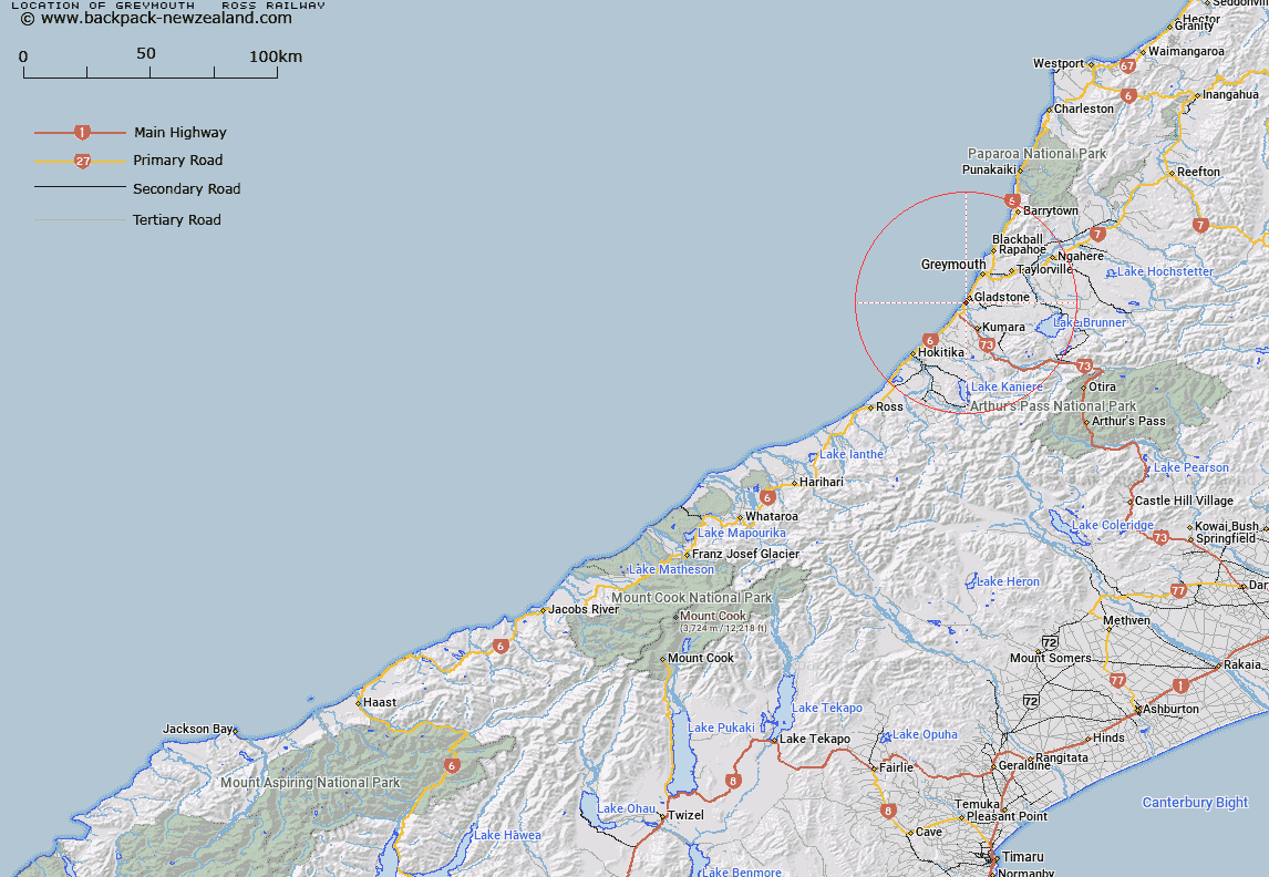
Greymouth - Ross Railway Map New Zealand


New Zealand places in our database
[ A ] [ B ] [ C ] [ D ] [ E ] [ F ] [ G ] [ H ] [ I ] [ J ] [ K ] [ L ] [ M ] [ N ] [ O ] [ P ] [ Q ] [ R ] [ S ] [ T ] [ U ] [ V ] [ W ] [ X ] [ Y ] [ Z ]


Closest 20 Railway Lines to Greymouth - Ross Railway

Rapahoe Branch Railway ( 16.81km )   Rapahoe Industrial Line ( 16.81km )   Rapahoe Branch ( 16.81km )   Rapahoe Branch Railway ( 16.81km )   Rewanui Branch Railway ( 20.57km )   Clough Cableway ( 51.17km )   Stillwater - Westport Railway ( 77.25km )   Stillwater-Ng?kawau Line ( 77.25km )   Stillwater - Westport Line ( 77.25km )   Ngakawau Branch ( 77.25km )   Stillwater - Westport Line ( 77.25km )   Midland Railway ( 82.49km )   Midland Line ( 82.49km )   Koranui Incline ( 106.11km )   Ngakawau Branch Railway ( 126.85km )   Seddonville Branch Railway ( 126.85km )   Weka Pass Railway ( 138.86km )   Wilsons Siding ( 150.69km )   Hornby Branch ( 158.67km )   Hornby Industrial Line ( 158.67km )   Tinwald Industrial Railway ( 159.74km )   Tinwald Branch ( 159.74km )   Tinwald Industrial Siding ( 159.74km )   Main North Line ( 193.14km )   Main North Railway ( 193.14km )   Kurow Branch Railway ( 261.46km )   Waiareka Industrial Railway ( 282.9km )   Waiareka Industrial Line ( 282.9km )   Otago Central Branch Railway ( 297.49km )   Main South Railway ( 298.29km )   Main South Line ( 298.29km )   Inch Valley Branch Railway ( 320.88km )   Makareao Branch Railway ( 320.88km )   Makareao Industrial Railway ( 324.49km )   Johnsonville Line ( 334.46km )   Johnsonville Branch Railway ( 334.46km )   Melling Branch Railway ( 343.68km )   Melling Branch ( 343.68km )   Gracefield Branch ( 343.8km )   Gracefield Industrial Line ( 343.8km )