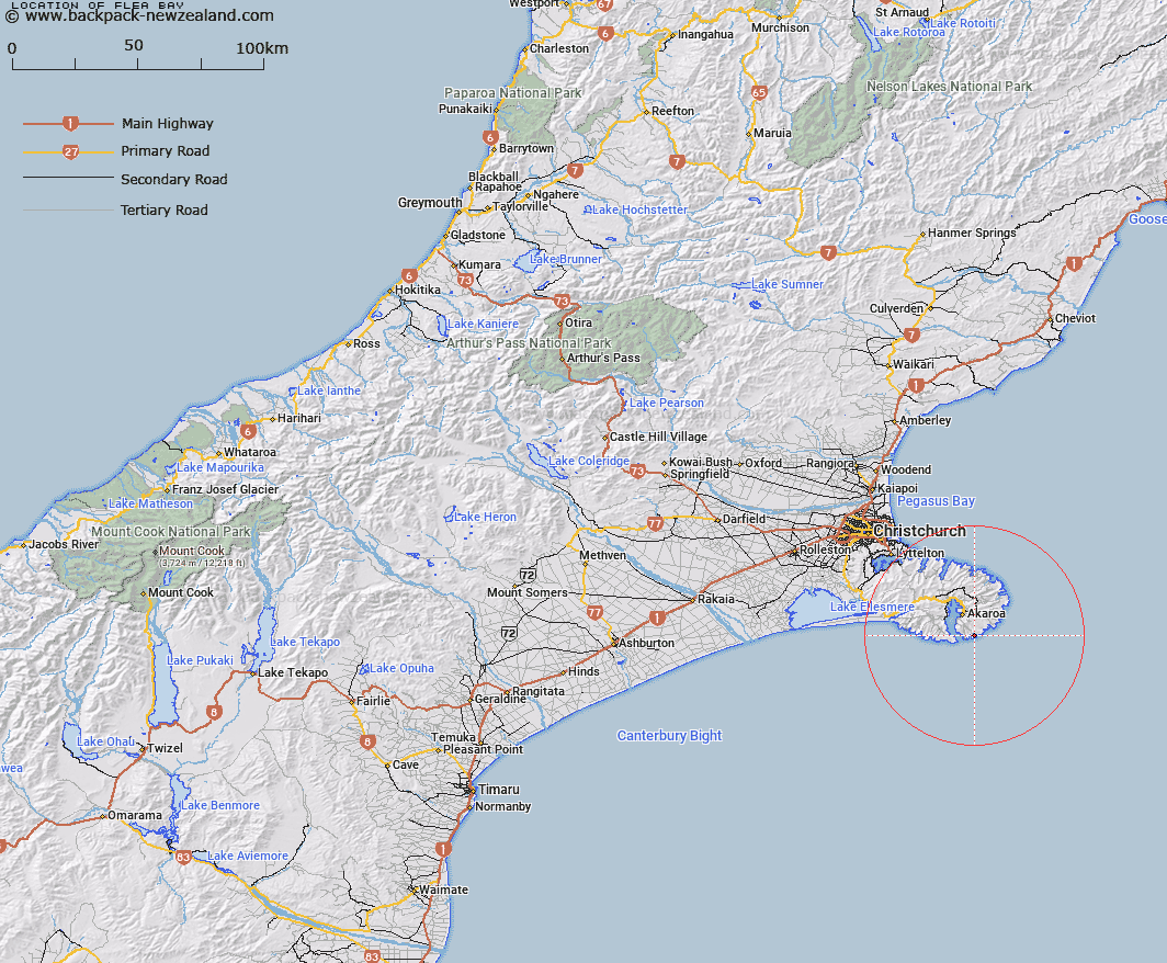
Map showing location of Flea Bay


LINZ description: Bay located approximately 5 km east north-east of the entrance to Akaroa Harbour
Latitude: -43.875094
Longitude: 173.011202
Northing: 5142000
Easting: 1600900
Land District: Canterbury
Feat Type: Bay


Scroll down to see a more detailed road map and below that a topographical map showing the location of Flea Bay. The road map has been supplied by openstreetmap and the topographical map of Flea Bay has been supplied by Land Information New Zealand (LINZ).

Yes you can use the top static map for you school/university project or personal website with a link back. Contact me for any commercial use.

Flea Bay Map New Zealand


New Zealand places in our database
[ A ] [ B ] [ C ] [ D ] [ E ] [ F ] [ G ] [ H ] [ I ] [ J ] [ K ] [ L ] [ M ] [ N ] [ O ] [ P ] [ Q ] [ R ] [ S ] [ T ] [ U ] [ V ] [ W ] [ X ] [ Y ] [ Z ]


Closest 20 Bays to Flea Bay

Island Nook ( 1.1km )   Damons Bay ( 1.57km )   Redcliffe Nook ( 2.23km )   The Amphitheatre ( 2.54km )   Haylocks Bay ( 2.84km )   Stony Bay ( 3.32km )   Reef Nook ( 3.97km )   Sleepy Bay ( 4.64km )   Otanerito Bay ( 5.38km )   Waihuakina Bay ( 5.8km )   Red Bay ( 7.2km )   Lucas Bay ( 7.3km )   Shell Bay ( 7.44km )   Titoki or Little Tikao Bay ( 7.85km )   Fishermans Bay ( 8.05km )   Scenery Nook ( 8.08km )   Mat White Bay ( 8.26km )   Mat Wight Bay ( 8.26km )   Squally Bay ( 8.27km )   Glen Bay ( 8.33km )   French Bay ( 8.66km )   Paua Bay ( 9.03km )   Childrens Bay ( 9.14km )   Ohinepaka Bay ( 9.24km )   Rocky Nook ( 9.52km )   Anchorage Bay ( 10.02km )   Goughs Bay ( 10.48km )   Akaroa Harbour ( 10.88km )   Lushington Bay ( 11.03km )   Tikao Bay ( 11.15km )   Whakamoa Bay ( 11.4km )   Takamatua Bay ( 11.61km )   Island Bay ( 11.8km )   Petit Carenage Bay ( 12.28km )   Long Bay ( 12.51km )   Robinsons Bay ( 12.84km )   French Farm Bay ( 13.35km )   Hickory Bay ( 13.47km )   Barrys Bay ( 14.3km )   Horseshoe Bay ( 14.36km )