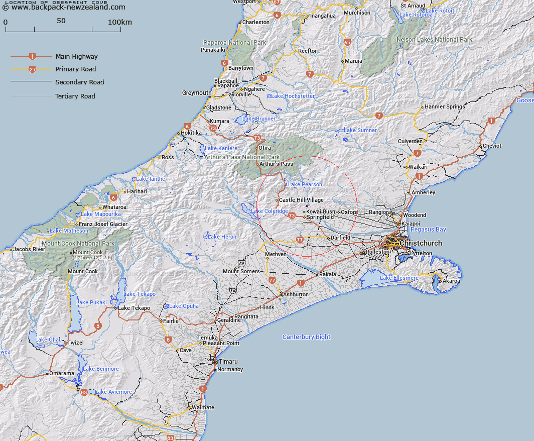
Map showing location of Deerprint Cove


LINZ description: Flat shingle area, on the right bank of the Waimakariri River, immediately north of Otarama Gorge. Kowai Survey District.
Latitude: -43.250963
Longitude: 171.948231
Northing: 5210778.6
Easting: 1514621.5
Land District: Canterbury
Feat Type: Bay


Scroll down to see a more detailed road map and below that a topographical map showing the location of Deerprint Cove. The road map has been supplied by openstreetmap and the topographical map of Deerprint Cove has been supplied by Land Information New Zealand (LINZ).

Yes you can use the top static map for you school/university project or personal website with a link back. Contact me for any commercial use.

Deerprint Cove Map New Zealand


New Zealand places in our database
[ A ] [ B ] [ C ] [ D ] [ E ] [ F ] [ G ] [ H ] [ I ] [ J ] [ K ] [ L ] [ M ] [ N ] [ O ] [ P ] [ Q ] [ R ] [ S ] [ T ] [ U ] [ V ] [ W ] [ X ] [ Y ] [ Z ]


Closest 20 Bays to Deerprint Cove

Smuggler Cove ( 3.7km )   Ritchies Bay ( 21.66km )   Shoal Bay ( 63.45km )   Home Bay ( 63.45km )   Harrisons Bight ( 64.57km )   Pinafore Bay ( 65.22km )   Pegasus Bay ( 65.23km )   Swell Bay ( 65.49km )   Breaksea Bay ( 65.92km )   Marion Bay ( 66.16km )   Governors Bay ( 70.78km )   McCormacks Bay ( 71.16km )   Rapaki Bay ( 71.33km )   Motukauatirahi Bay ( 71.99km )   Cass Bay ( 71.99km )   Motukauatirahi/Cass Bay ( 71.99km )   Corsair Bay ( 72.52km )   Motukauatiiti Bay ( 72.52km )   Motukauatiiti/Corsair Bay ( 72.52km )   Head of the Bay ( 72.82km )   Magazine Bay ( 72.86km )   Moncks Bay ( 73.05km )   Charteris Bay ( 74.65km )   Te Wharau/Charteris Bay ( 74.65km )   Lyttleton Harbour ( 75.11km )   Lyttelton Harbour/Whakaraup? ( 75.11km )   Hays Bay ( 75.15km )   Kaioruru/Church Bay ( 75.23km )   Church Bay ( 75.23km )   Gollans Bay ( 75.24km )   Otokitoki/Gollans Bay ( 75.24km )   Te Waipapa/Diamond Harbour ( 75.6km )   Te Waipapa Harbour ( 75.6km )   Livingstone Bay ( 76.43km )   Taylors Mistake ( 76.5km )   Slip Bay ( 76.89km )   Purau Bay ( 77.1km )   Harris Bay ( 77.13km )   Uncle Bay ( 77.34km )   Inainatu Bay ( 77.45km )