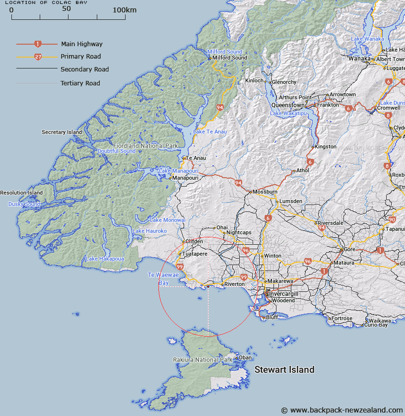
Map showing location of Colac Bay


LINZ description: Feature shown on: NZMS260-D46 158152; NZTopo50-CG09 083526;
Latitude: -46.366634
Longitude: 167.907332
Northing: 4852600
Easting: 1208300
Land District: Southland
Feat Type: Bay


Scroll down to see a more detailed road map and below that a topographical map showing the location of Colac Bay. The road map has been supplied by openstreetmap and the topographical map of Colac Bay has been supplied by Land Information New Zealand (LINZ).

Yes you can use the top static map for you school/university project or personal website with a link back. Contact me for any commercial use.

Colac Bay Map New Zealand


New Zealand places in our database
[ A ] [ B ] [ C ] [ D ] [ E ] [ F ] [ G ] [ H ] [ I ] [ J ] [ K ] [ L ] [ M ] [ N ] [ O ] [ P ] [ Q ] [ R ] [ S ] [ T ] [ U ] [ V ] [ W ] [ X ] [ Y ] [ Z ]


Closest 20 Bays to Colac Bay

Kawakaputa Bay ( 6.41km )   Taramea Bay ( 8.86km )   Mitchells Bay ( 9.35km )   Howells Roads ( 9.35km )   Hendersons Bay ( 9.75km )   Cosy Nook ( 15.56km )   Daffodil Bay ( 32.12km )   Whalers Bay ( 32.83km )   Mokomoko Inlet ( 34.25km )   Long Harry Bay ( 37.24km )   Te Waewae Bay ( 37.31km )   Bluff Harbour ( 39.36km )   Sealers Bay ( 47.93km )   North West Bay ( 48.38km )   Awarua Bay ( 48.41km )   Waituna Bay ( 48.68km )   Roderiques Anchorage ( 49.28km )   South Bay ( 50.24km )   Big Bight ( 51.36km )   Shand Bay ( 55.28km )   Wooding Bay ( 55.7km )   Lee Bay ( 57.34km )   Teal Bay ( 57.69km )   North Arm ( 57.82km )   Kaiporohu Bay ( 58.6km )   Horseshoe Bay ( 59.24km )   Torias Corner ( 59.73km )   Sawdust Bay ( 59.94km )   Bragg Bay ( 60.67km )   Sarah Cove ( 60.82km )   Kidney Fern Arm ( 61.05km )   Halfmoon Bay ( 61.22km )   Fuschia Bay ( 61.23km )   Kaipipi Bay ( 61.3km )   Little Kaipipi Bay ( 61.39km )   Linklater Bay ( 61.41km )   Thomson Bay ( 61.5km )   Dodgers Bay ( 61.57km )   Prices Inlet ( 61.59km )   Whalers Base ( 61.63km )