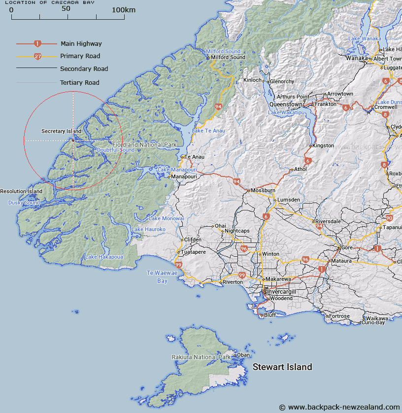
Map showing location of Cascada Bay


LINZ description: Small bay in Doubtful Sound at the south western end of Patea Passage.
Latitude: -45.291712
Longitude: 166.869326
Northing: 4966330
Easting: 1119276.7
Land District: Southland
Feat Type: Bay


Scroll down to see a more detailed road map and below that a topographical map showing the location of Cascada Bay. The road map has been supplied by openstreetmap and the topographical map of Cascada Bay has been supplied by Land Information New Zealand (LINZ).

Yes you can use the top static map for you school/university project or personal website with a link back. Contact me for any commercial use.

Cascada Bay Map New Zealand


New Zealand places in our database
[ A ] [ B ] [ C ] [ D ] [ E ] [ F ] [ G ] [ H ] [ I ] [ J ] [ K ] [ L ] [ M ] [ N ] [ O ] [ P ] [ Q ] [ R ] [ S ] [ T ] [ U ] [ V ] [ W ] [ X ] [ Y ] [ Z ]


Closest 20 Bays to Cascada Bay

Cascada Bay ( 0km )   Grono Bay ( 5.72km )   Groznoz Bay ( 5.72km )   Snug Cove ( 5.77km )   First Arm ( 6.38km )   Blanket Bay ( 8.73km )   Surgeon Bay ( 10.54km )   Thompson Sound ( 11.07km )   Lyall Bay ( 11.23km )   Anchorage Arm ( 11.37km )   Dagg Sound ( 12.38km )   Deas Cove ( 13.3km )   Doubtful Sound/Patea ( 13.89km )   Doubtful Sound ( 13.89km )   Neck Cove ( 14.16km )   Haulashore Cove ( 15.09km )   Crooked Arm ( 16.09km )   Open Cove ( 16.82km )   Te Poupouotu ( 17.79km )   Bradshaw Sound ( 18.15km )   Shelter Cove ( 20.33km )   Gaer Arm ( 21.27km )   Heel Cove ( 21.88km )   Precipice Cove ( 22.53km )   Nancy Sound ( 22.89km )   Foot Arm ( 23.7km )   Shoal Cove ( 24.75km )   Toe Cove ( 24.81km )   Olphert Cove ( 24.82km )   Third Cove ( 25.88km )   Vancouver Arm ( 26.12km )   Hall Arm ( 26.14km )   Deep Cove ( 27.33km )   Gold Arm ( 27.67km )   Breaksea Sound ( 28.31km )   Wanganella Cove ( 29.24km )   Second Cove ( 29.42km )   Broughton Arm ( 30.03km )   Helena Anchorage ( 30.05km )   Charles Sound ( 30.19km )