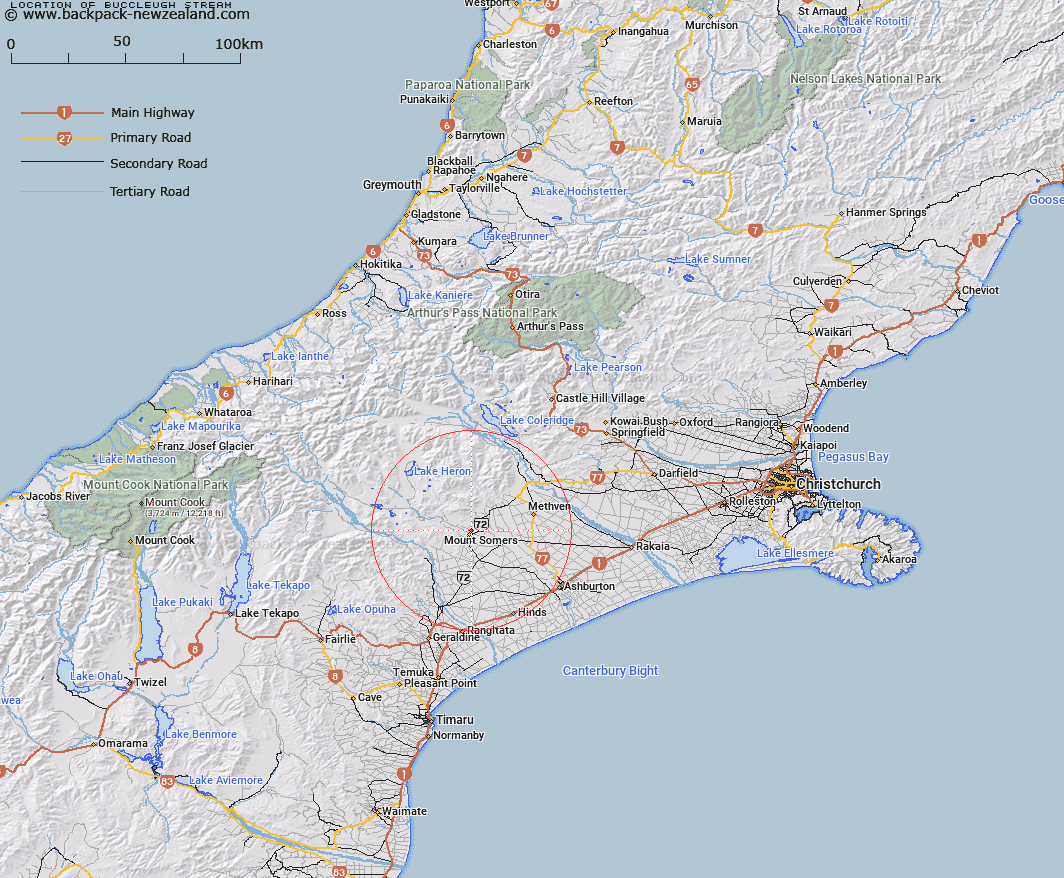
Map showing location of Buccleugh Stream


LINZ description: Right bank tributary of Bowyers Stream rising 2.2km South-west of Staveley Hill, flowing southward then eastward past Mount Somers and Rutland Homesteads, and joining Bowyers Stream North-east of Buccleuch locality. Blocks XI and XII, Alford Survey District
Latitude: -43.693371
Longitude: 171.407088
Northing: 5160950
Easting: 1471633
Land District: Canterbury
Feat Type: Stream


Scroll down to see a more detailed road map and below that a topographical map showing the location of Buccleugh Stream. The road map has been supplied by openstreetmap and the topographical map of Buccleugh Stream has been supplied by Land Information New Zealand (LINZ).

Yes you can use the top static map for you school/university project or personal website with a link back. Contact me for any commercial use.

Buccleugh Stream Map New Zealand


New Zealand places in our database
[ A ] [ B ] [ C ] [ D ] [ E ] [ F ] [ G ] [ H ] [ I ] [ J ] [ K ] [ L ] [ M ] [ N ] [ O ] [ P ] [ Q ] [ R ] [ S ] [ T ] [ U ] [ V ] [ W ] [ X ] [ Y ] [ Z ]


Closest 20 Streams to Buccleugh Stream

Buccleugh Stream ( 0km )   Furze Stream ( 0.64km )   Buccleuch Stream ( 0.77km )   South Branch Ashburton River/Hakatere ( 2.32km )   South Branch Ashburton River ( 2.32km )   Caves Stream ( 3.36km )   Stevenson Stream ( 4.37km )   Reid Stream ( 5.22km )   Hinds River North Branch ( 5.57km )   The Mill Creek ( 5.87km )   Stony Creek ( 6.02km )   Flynn Stream ( 6.45km )   Ghost Stream ( 6.7km )   Gawler Stream ( 7.22km )   Tinstone Creek ( 7.28km )   Rangitata Diversion Race ( 7.84km )   Bowyers Stream ( 9.02km )   Chapmans Creek ( 9.2km )   Staveley Stream ( 9.23km )   Limestone Creek ( 9.53km )   Surrey Stream ( 9.58km )   Woolshed Creek ( 9.66km )   Pony Stream ( 9.93km )   Picnic Creek ( 10.22km )   Blondin Stream ( 10.88km )   Hutt Creek ( 12.03km )   Morgan Stream ( 12.1km )   Broadleaf Stream ( 12.98km )   Stour River ( 13.14km )   Little Hinds Stream ( 13.24km )   Diggers Creek ( 13.27km )   Diamond Creek ( 13.29km )   Hinds River South Branch ( 13.86km )   Weta Stream ( 13.99km )   Hinds River ( 14.33km )   Blue Duck Stream ( 15.23km )   O'Shea Creek ( 15.53km )   Orr Stream ( 15.89km )   Grahams Creek ( 16.05km )   Chaffey Stream ( 16.14km )