Map showing location of Barney Creek


LINZ description: Feature shown on: NZMS260 K30 Edition 2 1984
Latitude: -42.11075
Longitude: 171.773639
Northing: 5337199.5
Easting: 1498611.2
Land District: Nelson
Feat Type: Stream


Scroll down to see a more detailed road map and below that a topographical map showing the location of Barney Creek. The road map has been supplied by openstreetmap and the topographical map of Barney Creek has been supplied by Land Information New Zealand (LINZ).

Yes you can use the top static map for you school/university project or personal website with a link back. Contact me for any commercial use.
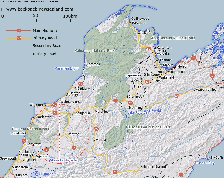
Barney Creek Map New Zealand


New Zealand places in our database
[ A ] [ B ] [ C ] [ D ] [ E ] [ F ] [ G ] [ H ] [ I ] [ J ] [ K ] [ L ] [ M ] [ N ] [ O ] [ P ] [ Q ] [ R ] [ S ] [ T ] [ U ] [ V ] [ W ] [ X ] [ Y ] [ Z ]


Closest 20 Streams to Barney Creek

Barney Creek ( 0km )   Bell Creek ( 0.82km )   Sawpit Creek ( 1.98km )   Pattinson Creek ( 2.43km )   Sleeper Creek ( 2.83km )   Dirty Mary Creek ( 2.84km )   Mawheraiti or Little Grey River ( 3.99km )   Jinks Creek ( 4.19km )   Maimai Creek ( 4.23km )   Jacks Creek ( 4.42km )   Donkey Creek ( 4.69km )   O'Malley Creek ( 4.89km )   Devils Creek ( 5.46km )   Giles Creek ( 5.53km )   Casolis Creek ( 5.72km )   Burkes Creek ( 6.04km )   Soldiers Creek ( 6.6km )   Slab Hut Creek ( 7.34km )   Murphy Creek ( 7.45km )   Antonios Creek ( 7.73km )   Chinkey Creek ( 7.77km )   Deadman Creek ( 7.98km )   Carton Creek ( 8.09km )   Waitahu River ( 8.28km )   Stony Creek ( 8.56km )   Rough and Tumble Creek ( 8.88km )   Auld Creek ( 9.09km )   Anderson Creek ( 9.49km )   Frying Pan Creek ( 9.64km )   No Gold Creek ( 9.73km )   Madman Creek ( 9.82km )   Flower Creek ( 9.98km )   Painkiller Creek ( 10.07km )   Ajax Creek ( 10.09km )   Stony Batter Creek ( 10.25km )   Murray Creek ( 10.35km )   Due North Creek ( 10.4km )   Redman Creek ( 10.45km )   Oriental Creek ( 10.62km )   Russell Creek ( 10.92km )