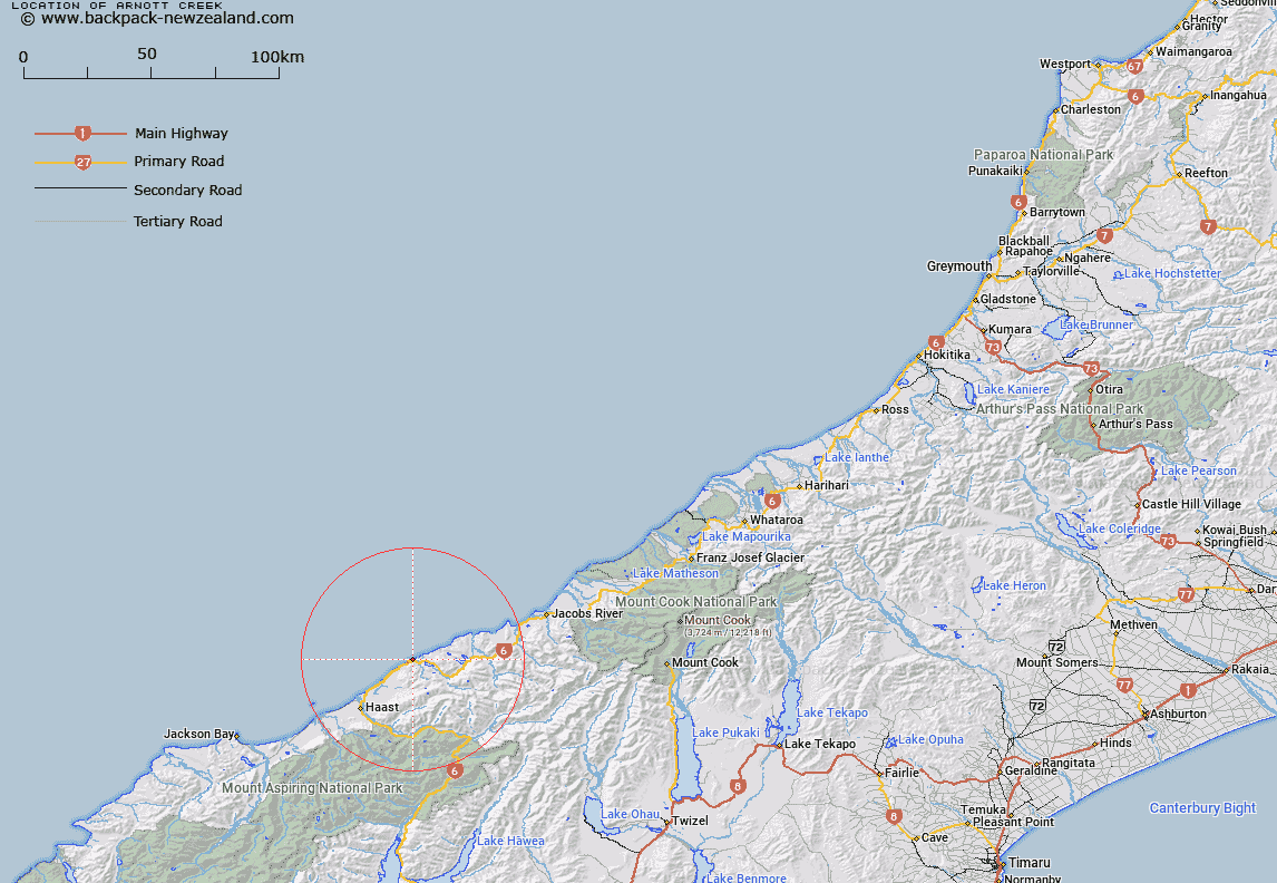
Map showing location of Arnott Creek


LINZ description: Stream crossing Paringa-Haast Road. Flows into Tasman Sea 12 chains north-east of Grave Creek. Arnott Survey District.
Latitude: -43.720266
Longitude: 169.21968
Northing: 5152247.6
Easting: 1295485.7
Land District: Westland
Feat Type: Stream


Scroll down to see a more detailed road map and below that a topographical map showing the location of Arnott Creek. The road map has been supplied by openstreetmap and the topographical map of Arnott Creek has been supplied by Land Information New Zealand (LINZ).

Yes you can use the top static map for you school/university project or personal website with a link back. Contact me for any commercial use.

Arnott Creek Map New Zealand


New Zealand places in our database
[ A ] [ B ] [ C ] [ D ] [ E ] [ F ] [ G ] [ H ] [ I ] [ J ] [ K ] [ L ] [ M ] [ N ] [ O ] [ P ] [ Q ] [ R ] [ S ] [ T ] [ U ] [ V ] [ W ] [ X ] [ Y ] [ Z ]


Closest 20 Streams to Arnott Creek

Pierce Creek ( 0.57km )   Farrel Creek ( 0.61km )   Farrell Creek ( 0.61km )   Harvey Creek ( 0.68km )   Rae Creek ( 0.73km )   Adam Creek ( 0.85km )   Murphy Creek ( 0.86km )   Grave Creek ( 0.87km )   Epitaph Creek ( 1.09km )   Bellard Creek ( 1.21km )   Penguin Creek ( 1.44km )   Mosquito Creek ( 1.58km )   Herring Stream ( 1.6km )   Venture Creek ( 1.63km )   Breccia Creek ( 1.9km )   Brecia Creek ( 1.9km )   Seal Creek ( 2.34km )   Mistake Creek ( 2.66km )   Mathias Creek ( 2.97km )   Matthies Creek ( 2.97km )   Dragon Creek ( 3.01km )   Moeraki River (Blue River) ( 3.21km )   Emily Creek ( 3.3km )   Grant Creek ( 3.31km )   Bishops Folly ( 3.99km )   Monro Creek ( 4.02km )   Bullock Creek ( 4.57km )   Cole Creek ( 4.57km )   Wells Creek ( 4.8km )   Fox Creek ( 4.84km )   Rocky River ( 4.86km )   Coal Creek ( 5.35km )   Access Creek ( 5.76km )   Monro Mistake ( 5.9km )   Arnott Water ( 6.44km )   Moeraki River ( 6.83km )   Cement Creek ( 6.84km )   Ship Creek ( 7.11km )   Tokakoriri Creek ( 7.34km )   Waterfall Creek ( 7.85km )