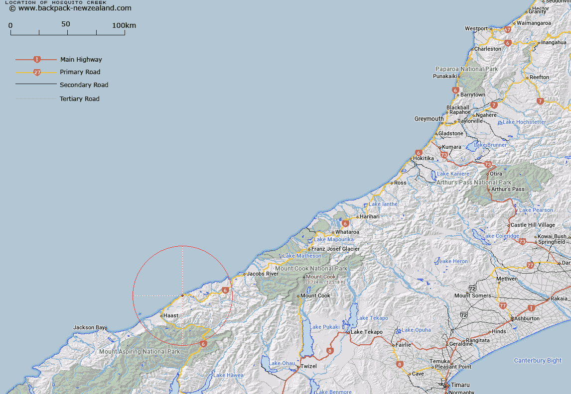
Map showing location of Mosquito Creek


LINZ description: Stream flowing into Breccia Creek from Trig. VA (Geodetic Code B199). Arnott Survey District.
Latitude: -43.73013
Longitude: 169.205579
Northing: 5151100
Easting: 1294400
Land District: Westland
Feat Type: Stream


Scroll down to see a more detailed road map and below that a topographical map showing the location of Mosquito Creek. The road map has been supplied by openstreetmap and the topographical map of Mosquito Creek has been supplied by Land Information New Zealand (LINZ).

Yes you can use the top static map for you school/university project or personal website with a link back. Contact me for any commercial use.

Mosquito Creek Map New Zealand


New Zealand places in our database
[ A ] [ B ] [ C ] [ D ] [ E ] [ F ] [ G ] [ H ] [ I ] [ J ] [ K ] [ L ] [ M ] [ N ] [ O ] [ P ] [ Q ] [ R ] [ S ] [ T ] [ U ] [ V ] [ W ] [ X ] [ Y ] [ Z ]


Closest 20 Streams to Mosquito Creek

Mosquito Creek ( 0km )   Brecia Creek ( 0.37km )   Breccia Creek ( 0.37km )   Penguin Creek ( 0.45km )   Epitaph Creek ( 0.81km )   Seal Creek ( 0.83km )   Rae Creek ( 0.9km )   Grave Creek ( 1.04km )   Adam Creek ( 1.08km )   Farrel Creek ( 1.2km )   Farrell Creek ( 1.2km )   Harvey Creek ( 1.22km )   Pierce Creek ( 1.27km )   Bellard Creek ( 1.34km )   Dragon Creek ( 1.51km )   Arnott Creek ( 1.58km )   Murphy Creek ( 1.62km )   Grant Creek ( 1.75km )   Emily Creek ( 1.79km )   Bishops Folly ( 2.42km )   Venture Creek ( 2.45km )   Mistake Creek ( 2.49km )   Matthies Creek ( 3.04km )   Mathias Creek ( 3.04km )   Herring Stream ( 3.16km )   Wells Creek ( 3.23km )   Bullock Creek ( 3.45km )   Cole Creek ( 3.45km )   Fox Creek ( 3.46km )   Coal Creek ( 3.9km )   Moeraki River (Blue River) ( 4.67km )   Monro Mistake ( 5.33km )   Rocky River ( 5.34km )   Cement Creek ( 5.36km )   Monro Creek ( 5.39km )   Ship Creek ( 5.54km )   Arnott Water ( 5.85km )   Access Creek ( 5.86km )   Moeraki River ( 7.64km )   Waita River ( 8.55km )