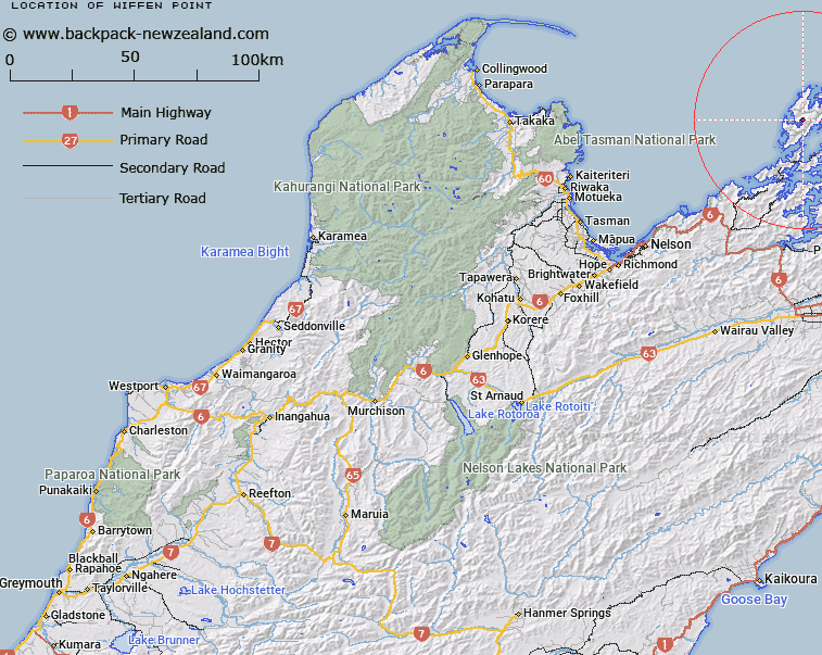
Map showing location of Wiffen Point


LINZ description: Feature shown on: NZMS260 P26; NZTopo50-BN28 705780
Latitude: -40.845866
Longitude: 173.836528
Northing: 5478016.4
Easting: 1670517.3
Land District: Nelson
Feat Type: Point


Scroll down to see a more detailed road map and below that a topographical map showing the location of Wiffen Point. The road map has been supplied by openstreetmap and the topographical map of Wiffen Point has been supplied by Land Information New Zealand (LINZ).

Yes you can use the top static map for you school/university project or personal website with a link back. Contact me for any commercial use.
Wiffen Point Map New Zealand


New Zealand places in our database
[ A ] [ B ] [ C ] [ D ] [ E ] [ F ] [ G ] [ H ] [ I ] [ J ] [ K ] [ L ] [ M ] [ N ] [ O ] [ P ] [ Q ] [ R ] [ S ] [ T ] [ U ] [ V ] [ W ] [ X ] [ Y ] [ Z ]


Closest 20 Points to Wiffen Point

Point George ( 1.85km )   Boulder Spit Point ( 2.36km )   Ragged Point ( 4.54km )   Two Bay Point ( 4.91km )   Fryingpan Point ( 4.98km )   Rock Point ( 5.06km )   Cape Zach ( 5.21km )   Seal Point ( 5.54km )   Te ?kau Point ( 6.37km )   Iron Pot Spur ( 6.66km )   Bonne Point ( 6.78km )   Pig Point ( 7.22km )   Round Point ( 7.27km )   ?k?rewa Point ( 7.76km )   Tunnel Point ( 7.95km )   Reef Point ( 8.17km )   Collinet Point ( 8.66km )   Channel Point ( 8.72km )   Half Way Point ( 8.89km )   Simpson Point ( 9.27km )   Clayface Point ( 9.46km )   Castle Head ( 9.68km )   Audibert Point ( 9.73km )   Cove Point ( 9.93km )   Cross Point ( 10.21km )   Bottle Point ( 10.24km )   Tongue Point ( 10.28km )   Whangapoto Point ( 10.88km )   Anchor Point ( 10.91km )   Cave Point ( 10.93km )   Reynaud Point ( 11.34km )   Moleta Point ( 11.46km )   Tokatapu Point ( 11.51km )   Moki Point ( 11.56km )   Te Ekeatekonganui (Reef Point) ( 11.59km )   Old Mans Head ( 11.64km )   Sauvage Point ( 11.9km )   Two Island Point ( 12.24km )   Trafalgar Point ( 12.7km )   Clay Point ( 12.87km )