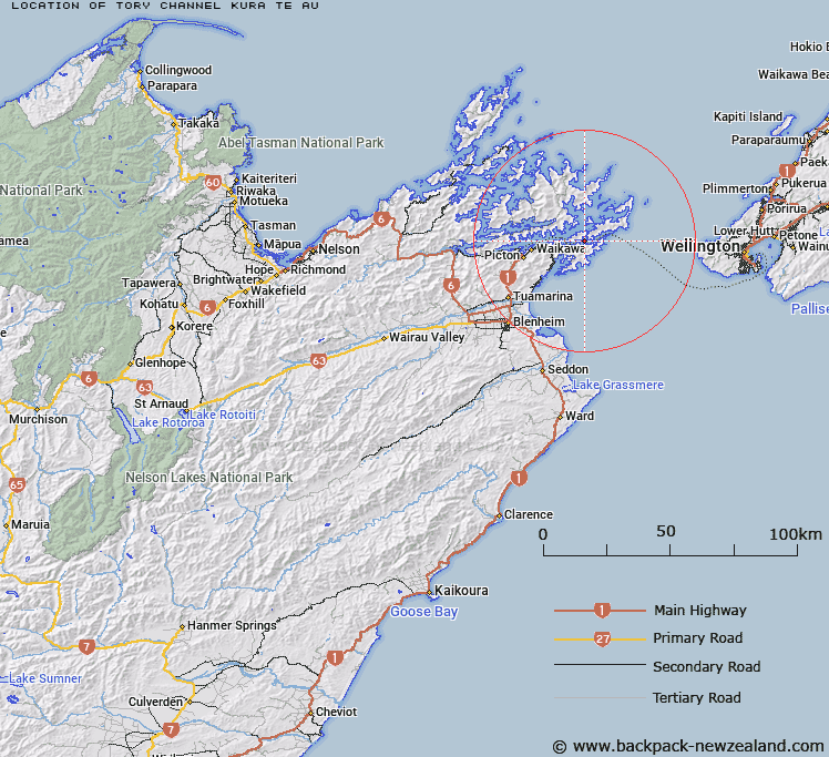
Map showing location of Tory Channel / Kura Te Au


LINZ description: A strait separating Arapaoa Island from Te Waipounamu, extending generally east-west from Dieffenbach Point in Queen Charlotte Sound / Tōtaranui to West Head and East Head in Cook Strait. Feature shown on: NZMS260 Q27 Edition 1 1980; Infomap 346-02 Te Wai Pounamu Edition 1 1995; NZTopo50-BQ29 969351-BP30ptBQ30 106369
Latitude: -41.239028
Longitude: 174.224833
Northing: 5433984.8
Easting: 1702638.4
Land District: Marlborough
Feat Type: Channel


Scroll down to see a more detailed road map and below that a topographical map showing the location of Tory Channel / Kura Te Au. The road map has been supplied by openstreetmap and the topographical map of Tory Channel / Kura Te Au has been supplied by Land Information New Zealand (LINZ).

Yes you can use the top static map for you school/university project or personal website with a link back. Contact me for any commercial use.

Tory Channel / Kura Te Au Map New Zealand


New Zealand places in our database
[ A ] [ B ] [ C ] [ D ] [ E ] [ F ] [ G ] [ H ] [ I ] [ J ] [ K ] [ L ] [ M ] [ N ] [ O ] [ P ] [ Q ] [ R ] [ S ] [ T ] [ U ] [ V ] [ W ] [ X ] [ Y ] [ Z ]


Closest 20 Channels to Tory Channel / Kura Te Au

Patten Passage ( 6.89km )   Cook Strait ( 20.83km )   Hikapu Reach ( 30.01km )   Allen Strait (Guards Pass) ( 30.23km )   Wait?t? Reach ( 35.89km )   Tawhitinui Reach ( 37.56km )   Apuau Channel ( 38.07km )   Te Kakaho Channel ( 40.22km )   Worlds End ( 40.69km )   Current Basin ( 47.82km )   Te Aumiti (French Pass) ( 48.1km )   Te Aumiti / French Pass ( 48.1km )   Fishermans Passage ( 48.29km )   Chaffers Passage ( 52.14km )   Rangitoto Roads ( 56.85km )   Stephens Passage ( 65.25km )   Rauoterangi Channel ( 72.9km )   Blind Channel ( 84.45km )   Te Kauangaomanaia (The Narrows) ( 364.74km )   Narrows ( 388.03km )   Town Reach ( 430.18km )   Tilby Channel ( 430.57km )   Otumoetai Channel ( 431.12km )   Ot?moetai Channel ( 431.12km )   Stella Passage ( 431.64km )   Western Channel ( 431.99km )   Maunganui Roads ( 433.39km )   Cutter Channel ( 433.74km )   Tauranga Entrance ( 434.17km )   Blakneys Channel ( 442.84km )   Tuapiro Channel ( 443.55km )   Katikati Entrance ( 445.98km )   The Needles ( 449.46km )   Manukau Entrance ( 467.49km )   Waiuku Channel ( 467.6km )   Papakura Channel ( 469.01km )   Purakau Channel ( 472.21km )   Wairopa Channel ( 473.95km )   The Gap ( 476km )   Sandspit Passage ( 489.39km )