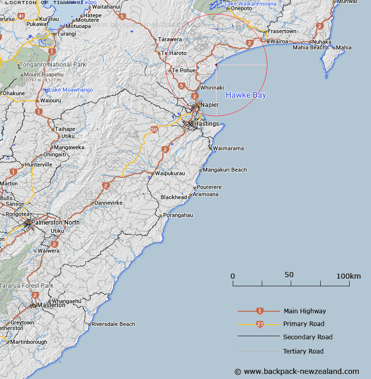
Map showing location of Tiwhanui


LINZ description: An historic site extending from spot height 395 m down to the coast. NZTopo50-BJ39 479523 to BJ40 487526.
Latitude: -39.20733
Longitude: 177.033304
Northing: 5652459.2
Easting: 1948287.6
Land District: Hawke's Bay
Feat Type: Site


Scroll down to see a more detailed road map and below that a topographical map showing the location of Tiwhanui. The road map has been supplied by openstreetmap and the topographical map of Tiwhanui has been supplied by Land Information New Zealand (LINZ).

Yes you can use the top static map for you school/university project or personal website with a link back. Contact me for any commercial use.

Tiwhanui Map New Zealand


New Zealand places in our database
[ A ] [ B ] [ C ] [ D ] [ E ] [ F ] [ G ] [ H ] [ I ] [ J ] [ K ] [ L ] [ M ] [ N ] [ O ] [ P ] [ Q ] [ R ] [ S ] [ T ] [ U ] [ V ] [ W ] [ X ] [ Y ] [ Z ]


Closest 20 Sites to Tiwhanui

Te Areare ( 16.85km )   Rangi?taahua ( 17.01km )   Te Rae-o-Tangoio ( 17.76km )   Ng?moerangi ( 18.85km )   Panepaoa ( 19.13km )   Tauwhare Papauma ( 29.99km )   Motu-o-R?r? ( 33.33km )   Takitimu Marae ( 37.77km )   Rangiahua Marae ( 38.19km )   Kihitu Pa ( 38.43km )   Pukekura Pa ( 38.93km )   Tupurupuru Pa ( 39.23km )   Puketapu Pa ( 40.31km )   Colenso Memorial ( 40.44km )   Waitangi Mission Station 1844-1852 ( 40.96km )   Kopuaroa Pa ( 41.43km )   Otatara Pa ( 41.88km )   Ohikakawera Pa ( 43.85km )   Waimako Pa ( 44.33km )   Iwitea Pa ( 45.09km )   Matahiwi Marae ( 45.71km )   Te Hora Pa ( 47.57km )   Ruahapia Marae ( 47.85km )   Runanga Pa ( 48.67km )   Pukehuia Pa ( 50.92km )   Whakaari Pa ( 51.26km )   Mokau Pa ( 52.65km )   Ohiti Pa ( 53.97km )   Bridge Pa ( 54.55km )   Korongata Marae ( 54.77km )   Mangaroa Hauora Marae ( 55.16km )   Te Hoe Whaling Station ( 71.99km )   Harema ( 72.66km )   Umurakau ( 74.11km )   Kopuawhara Disaster 1938 ( 76.42km )   Opepe Monument ( 85.55km )   Tapue ( 93.37km )   Rangihoua ( 93.49km )   Tapui Pa ( 94.07km )   Ngutuoha Pa ( 95.14km )