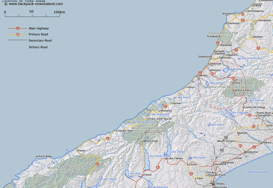
Map showing location of Third Gorge


LINZ description: Feature shown on: NZMS260 K33 Edition 1 1989 Limited Revision 1997
Latitude: -42.855861
Longitude: 171.374472
Northing: 5253909.9
Easting: 1467195.3
Land District: Westland
Feat Type: Valley


Scroll down to see a more detailed road map and below that a topographical map showing the location of Third Gorge. The road map has been supplied by openstreetmap and the topographical map of Third Gorge has been supplied by Land Information New Zealand (LINZ).

Yes you can use the top static map for you school/university project or personal website with a link back. Contact me for any commercial use.
Third Gorge Map New Zealand


New Zealand places in our database
[ A ] [ B ] [ C ] [ D ] [ E ] [ F ] [ G ] [ H ] [ I ] [ J ] [ K ] [ L ] [ M ] [ N ] [ O ] [ P ] [ Q ] [ R ] [ S ] [ T ] [ U ] [ V ] [ W ] [ X ] [ Y ] [ Z ]


Closest 20 Valleys to Third Gorge

Third Gorge ( 0km )   Tillers Gulch ( 3.53km )   Second Gorge ( 9.66km )   Otira Gorge ( 14.9km )   Whakarira Gorge ( 16.15km )   Toaroha Canyon ( 22.87km )   Macdonalds Gully ( 23.69km )   Humphreys Gully ( 24.54km )   Maori Gully ( 30.44km )   Liverpool Bills Gully ( 30.58km )   Frisco Canyon ( 30.67km )   Omatane Canyon ( 30.8km )   Pretty Womans Gully ( 30.88km )   German Gully ( 31.14km )   Kawau Gorge ( 31.57km )   Kakariki Canyon ( 33km )   Collier Gorge ( 33.52km )   Pylon Gully ( 33.64km )   German Gully ( 34.38km )   Wilson Gorge ( 36.93km )   Duras Gully ( 37.04km )   Smith Gorge ( 37.21km )   Mistake Gully ( 38.77km )   Bells Gully ( 40.07km )   Owen Gully ( 41.05km )   McEwan Gully ( 41.14km )   Hervey Gorge ( 41.23km )   Danger Gully ( 41.74km )   O'Neil Gully ( 42.03km )   Abes Gully ( 42.36km )   Maori Gully ( 43.76km )   Ebister Gully ( 43.82km )   Craigieburn Cutting ( 43.97km )   Rocky Gully ( 43.98km )   Bayley Gully ( 44.79km )   McElroy Gorge ( 45.07km )   Archer Gully ( 45.25km )   Wheelers Gully ( 45.37km )   Mirage Valley ( 45.73km )   McArthur Gorge ( 45.74km )