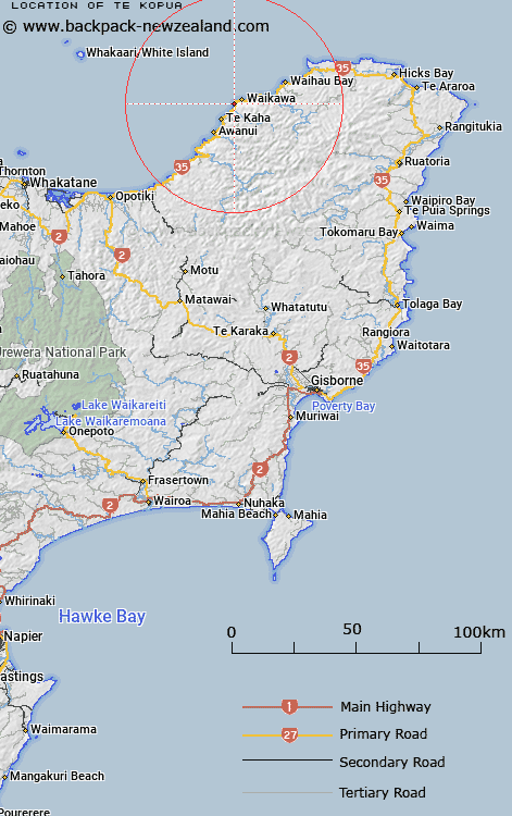
Map showing location of Te Kopua
LINZ description: Locality north of Te Kopua Stream, on the east coast approximately 7km east of Te Kaha 2km east of the Kereu River between Wharekura Point and Waikawa Point.
Latitude: -37.691466
Longitude: 177.725063
Northing: 5817897.7
Easting: 2016700
Land District: Gisborne
Feat Type: Locality
Latitude: -37.691466
Longitude: 177.725063
Northing: 5817897.7
Easting: 2016700
Land District: Gisborne
Feat Type: Locality

Scroll down to see a more detailed road map and below that a topographical map showing the location of Te Kopua. The road map has been supplied by openstreetmap and the topographical map of Te Kopua has been supplied by Land Information New Zealand (LINZ).
Yes you can use the top static map for you school/university project or personal website with a link back. Contact me for any commercial use.
[ A ] [ B ] [ C ] [ D ] [ E ] [ F ] [ G ] [ H ] [ I ] [ J ] [ K ] [ L ] [ M ] [ N ] [ O ] [ P ] [ Q ] [ R ] [ S ] [ T ] [ U ] [ V ] [ W ] [ X ] [ Y ] [ Z ]