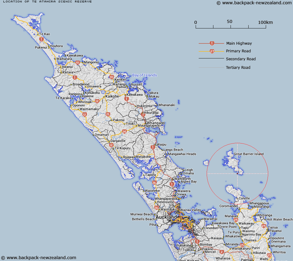
Map showing location of Te Atamira Scenic Reserve


LINZ description: No details provided by OTS and DOC
Latitude: -36.332222
Longitude: 175.475
Northing: 5976358.5
Easting: 1822147.3
Land District: North Auckland
Feat Type: Scenic Reserve


Scroll down to see a more detailed road map and below that a topographical map showing the location of Te Atamira Scenic Reserve. The road map has been supplied by openstreetmap and the topographical map of Te Atamira Scenic Reserve has been supplied by Land Information New Zealand (LINZ).

Yes you can use the top static map for you school/university project or personal website with a link back. Contact me for any commercial use.
Te Atamira Scenic Reserve Map New Zealand


New Zealand places in our database
[ A ] [ B ] [ C ] [ D ] [ E ] [ F ] [ G ] [ H ] [ I ] [ J ] [ K ] [ L ] [ M ] [ N ] [ O ] [ P ] [ Q ] [ R ] [ S ] [ T ] [ U ] [ V ] [ W ] [ X ] [ Y ] [ Z ]


Closest 20 Scenic Reserves to Te Atamira Scenic Reserve

Te Atamira Scenic Reserve ( 0km )   Rangatawhiri Scenic Reserve ( 3.08km )   Tryphena Scenic Reserve ( 5.34km )   Harataonga Scenic Reserve ( 18.04km )   Kotuku Point Scenic Reserve ( 22.19km )   Rakitu Island Scenic Reserve ( 22.98km )   Waikawau Bay Scenic Reserve ( 28.41km )   Ahirau Scenic Reserve ( 31.73km )   Papa Aroha Scenic Reserve ( 40.84km )   Taumatawahine Scenic Reserve ( 46.55km )   Black Jack Scenic Reserve ( 48.35km )   Atiu or Middle Island ( 48.4km )   Matarangi Bluff Scenic Reserve ( 48.87km )   Korapuki Island ( 49.34km )   Motutapere Island Scenic Reserve ( 49.93km )   Horseshoe Bay Scenic Reserve ( 53.05km )   Chiltern Scenic Reserve ( 54.76km )   Ohuka Bush Scenic Reserve ( 56.3km )   Waiau Falls Scenic Reserve ( 56.45km )   Buffalo Beach Scenic Reserve ( 56.77km )   Burgess Island Scenic Reserve ( 57.49km )   Smeltinghouse Bay Scenic Reserve ( 57.77km )   Sharp Point Scenic Reserve ( 57.99km )   Mahakirau Scenic Reserve ( 58.41km )   Kawau Island Scenic Reserve ( 59.4km )   Shakespeare's Cliff Scenic and Historic Reserve ( 59.77km )   Whitianga Rock Scenic and Historic Reserve ( 59.83km )   Leigh Scenic Reserve ( 60.23km )   Ti Point Scenic Reserve ( 60.64km )   Cook Bluff Scenic Reserve ( 60.83km )   Onewhero Pa Scenic Reserve ( 61.98km )   Waiheke Island Scenic Reserve ( 62.14km )   Kaitoke Scenic Reserve ( 62.27km )   Moturekareka Island Scenic Reserve ( 62.64km )   Diggers Hill Scenic Reserve ( 62.89km )   Kohatutara Scenic Reserve ( 63.05km )   Motutara Island Scenic Reserve ( 63.3km )   Te Matuku Bay Scenic Reserve ( 63.51km )   Wilson's Scenic Reserve ( 63.88km )   Te Haupa (Saddle) Island Scenic Reserve ( 68.04km )