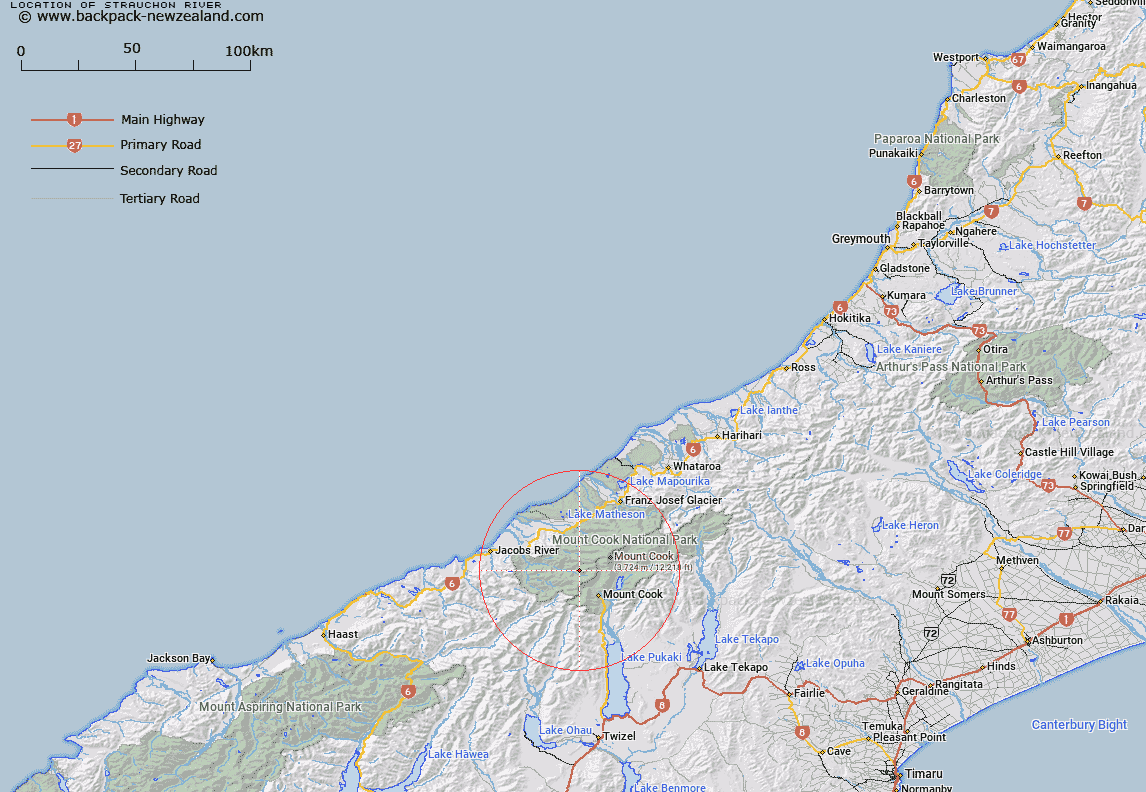
Map showing location of Strauchon River


LINZ description: Drains Strauchon Glacier. Formerly part of Copland River (31/03/1949 22:858). Block XIII Mount Cook Survey District.
Latitude: -43.641157
Longitude: 170.023511
Northing: 5163676.1
Easting: 1359923.8
Land District: Westland
Feat Type: Stream


Scroll down to see a more detailed road map and below that a topographical map showing the location of Strauchon River. The road map has been supplied by openstreetmap and the topographical map of Strauchon River has been supplied by Land Information New Zealand (LINZ).

Yes you can use the top static map for you school/university project or personal website with a link back. Contact me for any commercial use.

Strauchon River Map New Zealand


New Zealand places in our database
[ A ] [ B ] [ C ] [ D ] [ E ] [ F ] [ G ] [ H ] [ I ] [ J ] [ K ] [ L ] [ M ] [ N ] [ O ] [ P ] [ Q ] [ R ] [ S ] [ T ] [ U ] [ V ] [ W ] [ X ] [ Y ] [ Z ]


Closest 20 Streams to Strauchon River

Jungle Creek ( 0.67km )   Flashing Creek ( 2.04km )   Tekano Creek ( 2.05km )   Bluewater Creek ( 2.79km )   Scott Creek ( 3.85km )   Ruera River ( 4.08km )   Darkwater Stream ( 4.14km )   Splinter Creek ( 5.7km )   Crag Creek ( 6.17km )   Foam Creek ( 6.46km )   Creamy Creek ( 6.76km )   Shiels Creek ( 6.87km )   Stocking Stream ( 7.13km )   Hayter Stream ( 7.33km )   Stewart Stream ( 7.43km )   Sparkling Creek ( 7.53km )   Eugenie Stream ( 7.69km )   Open Creek ( 8.16km )   Palaver Creek ( 9.01km )   Therma Creek ( 9.08km )   Vickers Creek ( 9.21km )   T?t?wh?k? Creek ( 10.32km )   Architect Creek ( 10.57km )   Hooker River ( 10.83km )   Kitchener Creek ( 11.11km )   McKenna Creek ( 11.15km )   Cove Stream ( 11.29km )   McBain Creek ( 11.31km )   Husky Stream ( 11.65km )   Glencoe Stream ( 11.73km )   Black Birch Stream ( 11.84km )   Douglas River ( 12.05km )   Twain River ( 12.05km )   McPhee Creek ( 12.05km )   Chlorite Creek ( 12.19km )   Baking Oven Creek ( 12.21km )   Balfour River ( 12.32km )   Brassey Creek ( 12.52km )   Blue Stream ( 12.57km )   Driver Creek ( 12.66km )