Map showing location of Queenstown-Lakes District


LINZ description: The district that is administered by the Queenstown-Lakes District Council.
Latitude: -44.750366
Longitude: 168.956668
Northing: 5036822.9
Easting: 1279940.3
Land District: Otago
Feat Type: Local Government


Scroll down to see a more detailed road map and below that a topographical map showing the location of Queenstown-Lakes District. The road map has been supplied by openstreetmap and the topographical map of Queenstown-Lakes District has been supplied by Land Information New Zealand (LINZ).

Yes you can use the top static map for you school/university project or personal website with a link back. Contact me for any commercial use.
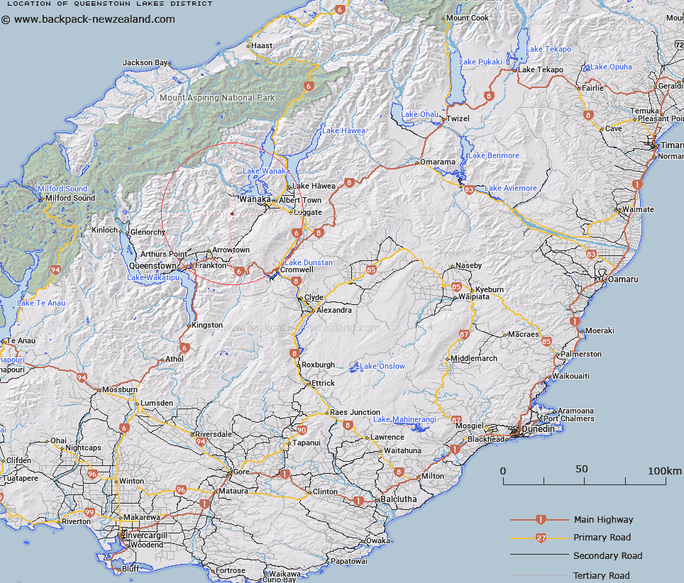
Queenstown-Lakes District Map New Zealand


New Zealand places in our database
[ A ] [ B ] [ C ] [ D ] [ E ] [ F ] [ G ] [ H ] [ I ] [ J ] [ K ] [ L ] [ M ] [ N ] [ O ] [ P ] [ Q ] [ R ] [ S ] [ T ] [ U ] [ V ] [ W ] [ X ] [ Y ] [ Z ]


Closest 20 Local Governments to Queenstown-Lakes District

Central Otago District ( 96.08km )   Otago Region ( 96.77km )   Maniatoto County ( 98.88km )   Maniototo County ( 98.88km )   Waitaki District ( 99.75km )   Southland Region ( 124.32km )   Waimate District ( 130.98km )   Clutha District ( 141.1km )   Gore District ( 144.02km )   Mackenzie District ( 145.71km )   Southland District ( 169.34km )   Dunedin City ( 174.3km )   Invercargill City ( 191.85km )   Timaru District ( 194.46km )   Westland District ( 203.98km )   West Coast Region ( 219.95km )   Ashburton District ( 230.88km )   Selwyn District ( 278.45km )   Canterbury Region ( 298.9km )   Waimakariri District ( 316.69km )   Christchurch City ( 322.22km )   Grey District ( 331.7km )   Hurunui District ( 371.07km )   Buller District ( 410.31km )   Kaikoura District ( 468.77km )   Tasman District ( 484.13km )   Marlborough District ( 505.87km )   Nelson City ( 519.41km )   Wellington City ( 612.87km )   Petone Borough ( 620.71km )   Pito-one Borough ( 620.71km )   Borough of Tawa ( 621.37km )   Borough of Tawa Flat ( 621.37km )   Lower Hutt City ( 625.59km )   Porirua City ( 630.29km )   Upper Hutt City ( 639.72km )   South Wairarapa District ( 661.71km )   Wellington Region ( 665.27km )   Carterton District ( 665.48km )   Kapiti Coast District ( 668km )