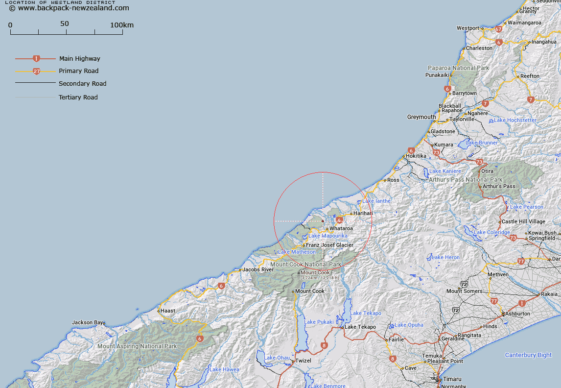
Map showing location of Westland District


LINZ description: The district that is administered by the Westland District Council.
Latitude: -43.204394
Longitude: 170.328991
Northing: 5213023.3
Easting: 1383008.4
Land District: Westland
Feat Type: Local Government


Scroll down to see a more detailed road map and below that a topographical map showing the location of Westland District. The road map has been supplied by openstreetmap and the topographical map of Westland District has been supplied by Land Information New Zealand (LINZ).

Yes you can use the top static map for you school/university project or personal website with a link back. Contact me for any commercial use.

Westland District Map New Zealand


New Zealand places in our database
[ A ] [ B ] [ C ] [ D ] [ E ] [ F ] [ G ] [ H ] [ I ] [ J ] [ K ] [ L ] [ M ] [ N ] [ O ] [ P ] [ Q ] [ R ] [ S ] [ T ] [ U ] [ V ] [ W ] [ X ] [ Y ] [ Z ]


Closest 20 Local Governments to Westland District

West Coast Region ( 17.74km )   Mackenzie District ( 84.38km )   Ashburton District ( 92.32km )   Selwyn District ( 104.53km )   Timaru District ( 116.39km )   Waimate District ( 128.89km )   Canterbury Region ( 132.66km )   Grey District ( 132.73km )   Waimakariri District ( 161.26km )   Waitaki District ( 175.12km )   Christchurch City ( 188.55km )   Hurunui District ( 189.42km )   Queenstown-Lakes District ( 203.98km )   Buller District ( 207.18km )   Maniatoto County ( 215.86km )   Maniototo County ( 215.86km )   Otago Region ( 232.49km )   Central Otago District ( 256.92km )   Tasman District ( 283.34km )   Kaikoura District ( 287.35km )   Dunedin City ( 297.54km )   Clutha District ( 313.18km )   Marlborough District ( 316.77km )   Nelson City ( 321.25km )   Southland Region ( 327.67km )   Gore District ( 332.75km )   Southland District ( 372.88km )   Invercargill City ( 389.34km )   Wellington City ( 425.86km )   Borough of Tawa ( 433.9km )   Borough of Tawa Flat ( 433.9km )   Petone Borough ( 434.51km )   Pito-one Borough ( 434.51km )   Lower Hutt City ( 439.98km )   Porirua City ( 442.79km )   Upper Hutt City ( 453.76km )   Kapiti Coast District ( 479.27km )   Wellington Region ( 480.16km )   South Wairarapa District ( 481.85km )   Carterton District ( 482.69km )