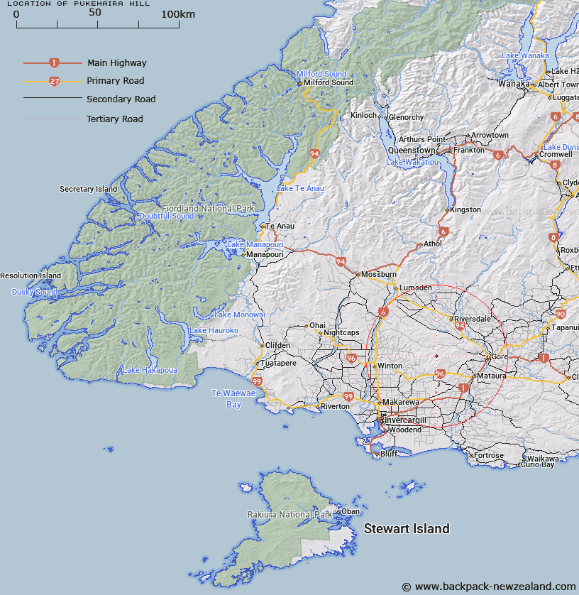
Map showing location of Pukemaira Hill


LINZ description: In Hokonui Forest, 5km south from Mt Peel. Height: 622m
Latitude: -46.08893
Longitude: 168.660553
Northing: 4886911.2
Easting: 1264537.3
Land District: Southland
Feat Type: Hill


Scroll down to see a more detailed road map and below that a topographical map showing the location of Pukemaira Hill. The road map has been supplied by openstreetmap and the topographical map of Pukemaira Hill has been supplied by Land Information New Zealand (LINZ).

Yes you can use the top static map for you school/university project or personal website with a link back. Contact me for any commercial use.

Pukemaira Hill Map New Zealand


New Zealand places in our database
[ A ] [ B ] [ C ] [ D ] [ E ] [ F ] [ G ] [ H ] [ I ] [ J ] [ K ] [ L ] [ M ] [ N ] [ O ] [ P ] [ Q ] [ R ] [ S ] [ T ] [ U ] [ V ] [ W ] [ X ] [ Y ] [ Z ]


Closest 20 Hills to Pukemaira Hill

Pukemaire ( 0km )   Pukemaira Hill ( 0km )   Pukemaire (The Cap) ( 0.04km )   Dunsdale ( 4.72km )   Mount Peel ( 4.85km )   West Peak ( 5.7km )   Rocky Knob ( 9.58km )   Ship Cone/?taupiri ( 9.82km )   Ship Cone ( 9.82km )   East Shoulder ( 10.93km )   Waimea Hill ( 11.46km )   Bare Hill ( 12.27km )   North Peak ( 14.87km )   Pebbly Hill ( 15km )   East Peak ( 16.86km )   Ben Bolt ( 16.9km )   Ben Callum ( 19.42km )   Forest Hill ( 20.62km )   Sharks Tooth Hill ( 20.76km )   Winton Hill ( 20.97km )   The Cone ( 21.14km )   The Bastion ( 23.54km )   Pyramid ( 23.77km )   Woody Knoll ( 24.47km )   Ben More ( 24.63km )   Waikaia Hill ( 27.45km )   Waikaka ( 28.37km )   Otapiri Peak ( 29.09km )   Waiparu ( 34.45km )   Big Hill ( 35.61km )   Cairn Peak ( 36.58km )   Otaraia Hill ( 36.72km )   Tower Hill ( 36.79km )   Kuriwao Hill ( 36.87km )   Ram Hill ( 37.02km )   Break My Neck ( 38.4km )   Landslip Hill ( 38.49km )   Raggedy Hill ( 39.16km )   Round Down ( 39.34km )   Red Castle ( 40.22km )