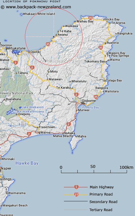
Map showing location of Pokahinu Point


LINZ description: Located at south-east end of Omaio Bay
Latitude: -37.80823
Longitude: 177.619001
Northing: 5805400
Easting: 2006700
Land District: Gisborne
Feat Type: Point


Scroll down to see a more detailed road map and below that a topographical map showing the location of Pokahinu Point. The road map has been supplied by openstreetmap and the topographical map of Pokahinu Point has been supplied by Land Information New Zealand (LINZ).

Yes you can use the top static map for you school/university project or personal website with a link back. Contact me for any commercial use.

Pokahinu Point Map New Zealand


New Zealand places in our database
[ A ] [ B ] [ C ] [ D ] [ E ] [ F ] [ G ] [ H ] [ I ] [ J ] [ K ] [ L ] [ M ] [ N ] [ O ] [ P ] [ Q ] [ R ] [ S ] [ T ] [ U ] [ V ] [ W ] [ X ] [ Y ] [ Z ]


Closest 20 Points to Pokahinu Point

Ohae Point ( 0.89km )   Puketapu Point ( 2.55km )   Okahu Point ( 3.83km )   Orangoihunui Point ( 4.22km )   Tokata Point ( 4.96km )   Te Kaha Point ( 8.96km )   Matakaoa Point ( 9.42km )   Kopuni Point ( 10.46km )   Wharekura Point ( 11.07km )   Haumiaroa Point ( 14.19km )   Ohinemango Point ( 15.24km )   Waikawa Point ( 17.17km )   Haurere Point ( 22.65km )   Taratuia Point ( 31.91km )   Orete Point ( 33.69km )   Te Ahikehe Point ( 37.24km )   Kopongatahi Point ( 42.15km )   Okoia Point ( 42.92km )   Waitapu Point ( 43.34km )   Cape Runaway ( 43.94km )   Tahurua Point ( 47.22km )   Pukeruru Point ( 47.93km )   Troup Head ( 48.68km )   Pinnacle Head ( 48.94km )   North East Point ( 49.55km )   Raetoka Point ( 49.67km )   Toritori Point ( 49.83km )   Motuore Point ( 50.14km )   Potikirua Point ( 50.33km )   Te Kauri Point ( 50.72km )   Paparoa Point ( 51.01km )   Te Matawiwi ( 51.23km )   Te Matawiwi Point ( 51.26km )   Whitiwhiti Point ( 52.6km )   Kohi Point ( 55.02km )   Lottin Point (Wakatiri) ( 57.44km )   Midway Point ( 60.49km )   Hukanui Point ( 63.13km )   Hukainui Point ( 63.13km )   Haupara Point ( 66.69km )