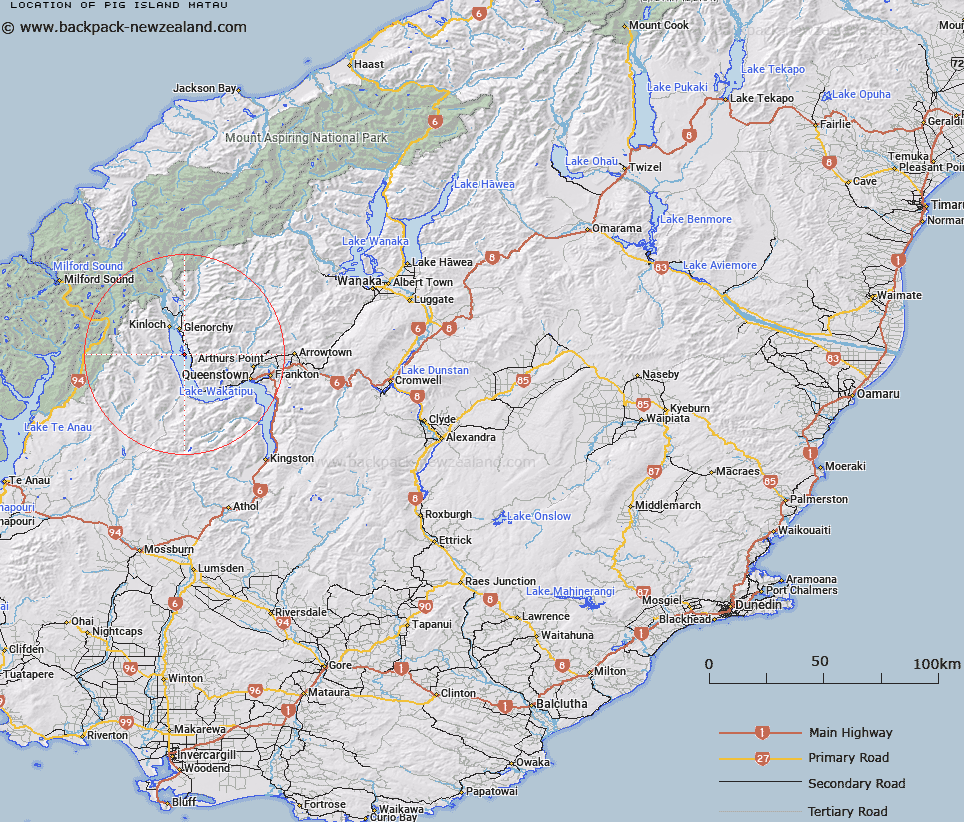
Map showing location of Pig Island/Mātau


LINZ description: Feature shown on: NZMS260-E41 477745; NZTopo50-CB10 377129;
Latitude: -44.944596
Longitude: 168.407927
Northing: 5012937.6
Easting: 1237724.7
Land District: Otago
Feat Type: Island


Scroll down to see a more detailed road map and below that a topographical map showing the location of Pig Island/Mātau. The road map has been supplied by openstreetmap and the topographical map of Pig Island/Mātau has been supplied by Land Information New Zealand (LINZ).

Yes you can use the top static map for you school/university project or personal website with a link back. Contact me for any commercial use.
Pig Island/Mātau Map New Zealand


New Zealand places in our database
[ A ] [ B ] [ C ] [ D ] [ E ] [ F ] [ G ] [ H ] [ I ] [ J ] [ K ] [ L ] [ M ] [ N ] [ O ] [ P ] [ Q ] [ R ] [ S ] [ T ] [ U ] [ V ] [ W ] [ X ] [ Y ] [ Z ]


Closest 20 Islands to Pig Island/Mātau

Tree Island ( 1.35km )   Pigeon Island/W?w?hi Waka ( 2.62km )   Pigeon Island ( 2.62km )   Hogget Island ( 17.87km )   Hidden Island ( 23.55km )   Lion Island ( 43.27km )   Lee Island ( 43.36km )   Lone Island ( 48.08km )   Dot Island ( 48.58km )   Entrance Island ( 51.15km )   The Island ( 58.3km )   Centre Island ( 59.33km )   Ruby Island ( 62.18km )   Doubtful Island ( 62.75km )   Mou Tapu ( 63.73km )   Crescent Island ( 63.73km )   Erin Island ( 63.83km )   Bute Island ( 64.09km )   Bull Island ( 65.84km )   Cumbrae Island ( 65.87km )   Arran Island ( 66.06km )   Brig Rock ( 67.72km )   Pigeon Island ( 68.74km )   Harwich Island ( 68.74km )   Mou Waho ( 68.74km )   Stevensons Island ( 69.3km )   Mervyn Island ( 70.28km )   Dome Islands ( 72.13km )   Baybles Island ( 74.1km )   Gorge Islands ( 86.76km )   Buncrana Island ( 89.46km )   Inch Keith ( 89.68km )   Browne Island ( 90.14km )   Houseroof Rock ( 90.85km )   Rona Island ( 91.08km )   Silver Island ( 92.64km )   Isolde Island ( 93.89km )   Belle Vue Island ( 94km )   Mahara Island ( 94.78km )   Holmwood Island ( 95.03km )