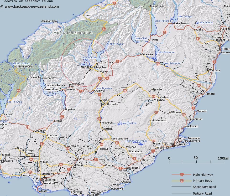
Map showing location of Crescent Island


LINZ description: Island west of The Peninsula at Lake Wanaka
Latitude: -44.608046
Longitude: 169.061407
Northing: 5053039.5
Easting: 1287465.9
Land District: Otago
Feat Type: Island


Scroll down to see a more detailed road map and below that a topographical map showing the location of Crescent Island. The road map has been supplied by openstreetmap and the topographical map of Crescent Island has been supplied by Land Information New Zealand (LINZ).

Yes you can use the top static map for you school/university project or personal website with a link back. Contact me for any commercial use.

Crescent Island Map New Zealand


New Zealand places in our database
[ A ] [ B ] [ C ] [ D ] [ E ] [ F ] [ G ] [ H ] [ I ] [ J ] [ K ] [ L ] [ M ] [ N ] [ O ] [ P ] [ Q ] [ R ] [ S ] [ T ] [ U ] [ V ] [ W ] [ X ] [ Y ] [ Z ]


Closest 20 Islands to Crescent Island

Crescent Island ( 0km )   Mou Tapu ( 0km )   The Island ( 5.48km )   Stevensons Island ( 6.03km )   Mou Waho ( 6.27km )   Harwich Island ( 6.27km )   Pigeon Island ( 6.27km )   Bull Island ( 7.24km )   Ruby Island ( 8.77km )   Silver Island ( 28.92km )   Hogget Island ( 56.59km )   Hidden Island ( 60.79km )   Pigeon Island ( 63.38km )   Pigeon Island/W?w?hi Waka ( 63.38km )   Pig Island ( 63.73km )   Pig Island/M?tau ( 63.73km )   Tree Island ( 64.82km )   Gull Island ( 79.16km )   Stafford Rocks ( 80.16km )   Seal Rocks ( 80.4km )   Browne Island ( 82.68km )   The Sugar Loaf ( 83.54km )   Barn Islands ( 84.12km )   Gorge Islands ( 84.17km )   Open Bay Islands ( 84.29km )   Popotai Island ( 84.33km )   Taumaka Island ( 84.37km )   Bignell Reef ( 84.64km )   Turnagain Island ( 87.44km )   Junction Island ( 88.96km )   Black Jacks Island ( 90.52km )   Goose Neck Island ( 92.13km )   Whanau Island ( 92.55km )   Mervyn Island ( 97.47km )   Brig Rock ( 101.36km )   Lion Island ( 105.04km )   Lee Island ( 105.15km )   Teviot Island ( 105.55km )   Morgans Island ( 106.57km )   Lone Island ( 111.16km )