Map showing location of Picnic Creek


LINZ description: Feature shown on: NZMS260 G42 Edition 1 1990
Latitude: -45.188556
Longitude: 169.292861
Northing: 4989414.8
Easting: 1308781.8
Land District: Otago
Feat Type: Stream


Scroll down to see a more detailed road map and below that a topographical map showing the location of Picnic Creek. The road map has been supplied by openstreetmap and the topographical map of Picnic Creek has been supplied by Land Information New Zealand (LINZ).

Yes you can use the top static map for you school/university project or personal website with a link back. Contact me for any commercial use.
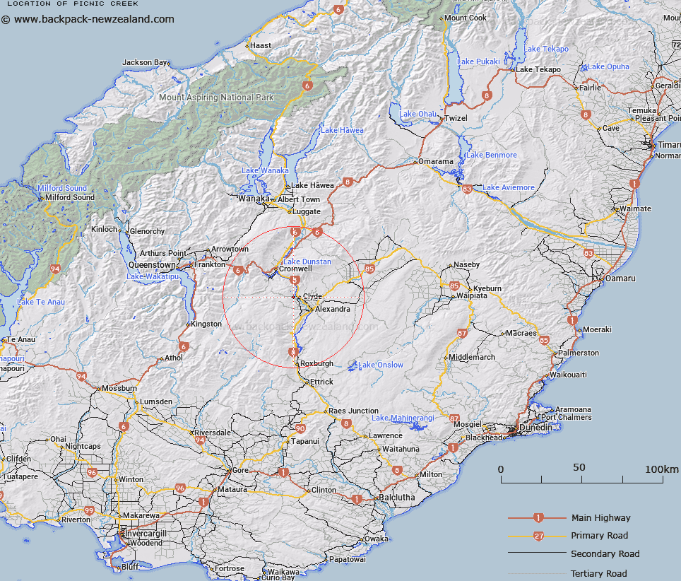
Picnic Creek Map New Zealand


New Zealand places in our database
[ A ] [ B ] [ C ] [ D ] [ E ] [ F ] [ G ] [ H ] [ I ] [ J ] [ K ] [ L ] [ M ] [ N ] [ O ] [ P ] [ Q ] [ R ] [ S ] [ T ] [ U ] [ V ] [ W ] [ X ] [ Y ] [ Z ]


Closest 20 Streams to Picnic Creek

Picnic Creek ( 0km )   Burton Creek ( 1.86km )   Weatherall Creek ( 2.48km )   Dairy Creek ( 3.51km )   McKenzie Creek ( 3.73km )   Five Mile Creek ( 3.76km )   Shepherds Creek ( 4.08km )   Byford Creek ( 5.11km )   Waipuna Creek ( 5.81km )   Waikerikeri Creek ( 6.03km )   Jackson Creek ( 6.04km )   Fish Creek ( 6.28km )   Coal Creek ( 7.12km )   Omeo Creek ( 7.58km )   Hawks Burn ( 8.1km )   Earnscleugh or Fraser River ( 9.13km )   Waterfall Creek ( 9.27km )   Italian Creek ( 9.33km )   Tumatakuru Creek ( 9.8km )   Springvale Creek ( 10.63km )   Aldinga Creek ( 10.95km )   Leaning Rock Creek ( 11.02km )   Halfmile Creek ( 11.14km )   Ainsley Creek ( 11.18km )   Rough Creek ( 11.22km )   Sonora Creek ( 11.34km )   Hawks Burn South Branch ( 11.36km )   Rough Creek ( 11.53km )   Yard Creek ( 11.7km )   Hawks Burn North Branch ( 12km )   Dry Creek ( 12.47km )   Nine Mile Creek ( 12.72km )   Conroys Creek ( 12.78km )   Shepherds Creek ( 13.34km )   Brassknocker Creek ( 13.78km )   Young Hill Creek ( 14km )   Turnipy Creek ( 14.52km )   Butchers Creek ( 14.52km )   Brewery Creek ( 14.68km )   Firewood Creek ( 15.19km )