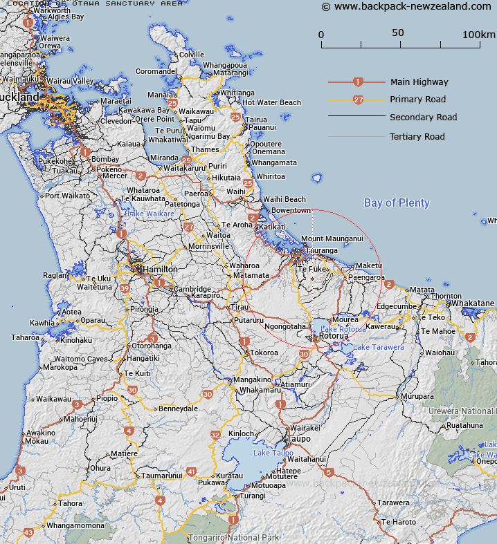
Map showing location of Otawa Sanctuary Area
LINZ description: A Crown protected area approximately 9 km southwest of Te Puke, Bay of Plenty. NZTopo50-BD37 846085
Latitude: -37.826518
Longitude: 176.233575
Northing: 5808504.7
Easting: 1884604.5
Land District: South Auckland
Feat Type: Sanctuary Area
Latitude: -37.826518
Longitude: 176.233575
Northing: 5808504.7
Easting: 1884604.5
Land District: South Auckland
Feat Type: Sanctuary Area

Scroll down to see a more detailed road map and below that a topographical map showing the location of Otawa Sanctuary Area. The road map has been supplied by openstreetmap and the topographical map of Otawa Sanctuary Area has been supplied by Land Information New Zealand (LINZ).
Yes you can use the top static map for you school/university project or personal website with a link back. Contact me for any commercial use.
[ A ] [ B ] [ C ] [ D ] [ E ] [ F ] [ G ] [ H ] [ I ] [ J ] [ K ] [ L ] [ M ] [ N ] [ O ] [ P ] [ Q ] [ R ] [ S ] [ T ] [ U ] [ V ] [ W ] [ X ] [ Y ] [ Z ]