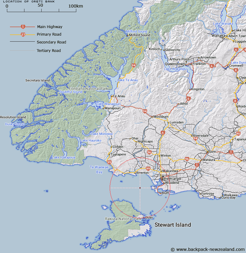
Map showing location of Ōreti Bank


LINZ description: Foveaux Strait. Rises from 30m to 13m deep.
Latitude: -46.533333
Longitude: 168.083333
Northing: 4834938.5
Easting: 1222990.1
Land District: Southland
Feat Type: Bank


Scroll down to see a more detailed road map and below that a topographical map showing the location of Ōreti Bank. The road map has been supplied by openstreetmap and the topographical map of Ōreti Bank has been supplied by Land Information New Zealand (LINZ).

Yes you can use the top static map for you school/university project or personal website with a link back. Contact me for any commercial use.

Ōreti Bank Map New Zealand


New Zealand places in our database
[ A ] [ B ] [ C ] [ D ] [ E ] [ F ] [ G ] [ H ] [ I ] [ J ] [ K ] [ L ] [ M ] [ N ] [ O ] [ P ] [ Q ] [ R ] [ S ] [ T ] [ U ] [ V ] [ W ] [ X ] [ Y ] [ Z ]


Closest 20 Banks to Ōreti Bank

Poutama Bank ( 101.07km )   Adieu Bank ( 159.76km )   Pendulo Bank ( 160.06km )   Espinosa Bank ( 160.32km )   Paturau Bank ( 741.81km )   Nicholson Bank ( 772.39km )   The Shellbanks ( 773.92km )   Middle Bank ( 775.28km )   Palliser Bank ( 784.35km )   Opouawe Bank ( 793.59km )   Kaukau Bank ( 808.69km )   Pahaua Bank ( 809.77km )   Hunter Bank ( 821.36km )   Kaiwhata Bank ( 855.94km )   Adams Bank ( 856.07km )   Whareama Bank ( 887.42km )   Graham Bank ( 898.18km )   Patea Banks ( 906.58km )   South Trap ( 906.91km )   North Trap ( 907.13km )   Otutere Bank ( 1073.76km )   Raglan Bar ( 1117.86km )   South Bank ( 1176.62km )   North Bank ( 1178.88km )   Poutawa Bank ( 1184.53km )   Kuri Banks ( 1185.65km )   Huia Bank ( 1185.8km )   Hangore Bank ( 1186.26km )   Karore Bank ( 1189.85km )   Centre Bank ( 1190.79km )   Hikihiki Bank ( 1190.88km )   Te Tau Bank ( 1192.8km )   Matakana Bank ( 1193.33km )   Motukaraka Bank ( 1197.63km )   Ariel Bank ( 1207.36km )   Duder Spit ( 1218.34km )   Omokoiti Flats ( 1228.95km )   Kaipara Flats ( 1234.01km )   Kakaraia Flats ( 1238.03km )   Tapora Bank ( 1238.79km )