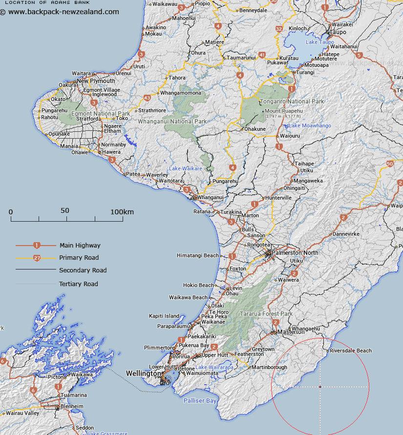
Map showing location of Adams Bank


LINZ description: A bank offshore from the Wairarapa coast. Depicted on Palliser Chart©, Mitchell, 1988.
Latitude: -41.3592
Longitude: 176.0146
Northing: 5416981.4
Easting: 1852166
Land District: Wellington
Feat Type: Bank


Scroll down to see a more detailed road map and below that a topographical map showing the location of Adams Bank. The road map has been supplied by openstreetmap and the topographical map of Adams Bank has been supplied by Land Information New Zealand (LINZ).

Yes you can use the top static map for you school/university project or personal website with a link back. Contact me for any commercial use.

Adams Bank Map New Zealand


New Zealand places in our database
[ A ] [ B ] [ C ] [ D ] [ E ] [ F ] [ G ] [ H ] [ I ] [ J ] [ K ] [ L ] [ M ] [ N ] [ O ] [ P ] [ Q ] [ R ] [ S ] [ T ] [ U ] [ V ] [ W ] [ X ] [ Y ] [ Z ]


Closest 20 Banks to Adams Bank

Kaiwhata Bank ( 5.75km )   Whareama Bank ( 31.39km )   Pahaua Bank ( 46.3km )   Kaukau Bank ( 49.52km )   Opouawe Bank ( 62.68km )   Palliser Bank ( 74.07km )   Nicholson Bank ( 106.59km )   Hunter Bank ( 109.37km )   Middle Bank ( 189.25km )   South Trap ( 207.06km )   Graham Bank ( 209.49km )   North Trap ( 209.82km )   Patea Banks ( 223.77km )   The Shellbanks ( 265.33km )   Otutere Bank ( 281.46km )   Paturau Bank ( 323.02km )   Kuri Banks ( 336.93km )   Ariel Bank ( 355.71km )   Raglan Bar ( 408.22km )   Centre Bank ( 412.9km )   Matakana Bank ( 416.69km )   Te Arawa High ( 449.78km )   Poutawa Bank ( 487.15km )   Hikihiki Bank ( 489.15km )   Hangore Bank ( 491.01km )   South Bank ( 493.93km )   North Bank ( 497.05km )   Karore Bank ( 497.38km )   Huia Bank ( 497.42km )   Te Tau Bank ( 500.48km )   Motukaraka Bank ( 504.28km )   Duder Spit ( 518.66km )   Omokoiti Flats ( 558.84km )   Kaipara Flats ( 560.21km )   Kakaraia Flats ( 564.69km )   Tapora Bank ( 571.83km )   Lady Franklin Bank ( 577.96km )   Middle Bank ( 584.71km )   Mair Bank ( 627.06km )   Calliope Bank ( 627.65km )