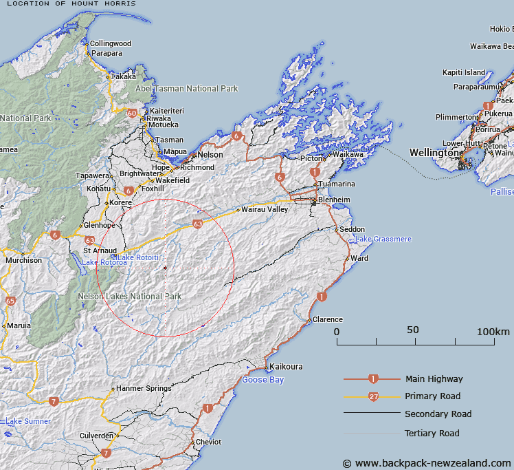
Map showing location of Mount Morris


LINZ description: A peak in between Branch and Leatham Rivers at the head of Hand Setting Stream and Grieg Stream tributaries
Latitude: -41.872803
Longitude: 173.121679
Northing: 5364338.9
Easting: 1610097.2
Land District: Marlborough
Feat Type: Hill


Scroll down to see a more detailed road map and below that a topographical map showing the location of Mount Morris. The road map has been supplied by openstreetmap and the topographical map of Mount Morris has been supplied by Land Information New Zealand (LINZ).

Yes you can use the top static map for you school/university project or personal website with a link back. Contact me for any commercial use.

Mount Morris Map New Zealand


New Zealand places in our database
[ A ] [ B ] [ C ] [ D ] [ E ] [ F ] [ G ] [ H ] [ I ] [ J ] [ K ] [ L ] [ M ] [ N ] [ O ] [ P ] [ Q ] [ R ] [ S ] [ T ] [ U ] [ V ] [ W ] [ X ] [ Y ] [ Z ]


Closest 20 Hills to Mount Morris

Scotts Knob ( 6.57km )   Boundary ( 11.32km )   Saxton ( 11.53km )   Pinnacle ( 14.4km )   Blowhard ( 14.95km )   Blue Mountain ( 17.66km )   Pudding ( 18.86km )   Mount Impey ( 19.12km )   Bounds ( 19.14km )   Mount Nobel ( 20.5km )   Elise Peak ( 20.83km )   Shingle Peak ( 20.85km )   Pinnacle ( 21.24km )   Beebys Knob ( 22.15km )   One Tree ( 22.29km )   Whether Hill ( 22.74km )   Mount McRae ( 22.87km )   Chrome ( 23.09km )   Severn ( 23.36km )   Spaniard Face ( 23.94km )   Traverse ( 24.07km )   The Pinnacle ( 24.1km )   Porters Knob ( 24.14km )   Peanter Peak ( 24.14km )   Stockyard Face ( 24.22km )   Water Hill ( 24.25km )   Mount Chrisholm ( 24.51km )   Black Hill ( 25.19km )   Spray ( 25.4km )   Star Hill ( 25.86km )   Mount Cashel ( 26.04km )   Mount Robert ( 26.1km )   Pourangahau / Mount Robert ( 26.1km )   Mount Phillips ( 26.22km )   The Camel ( 26.65km )   The Pinnacles ( 27.08km )   Mount Augarde ( 27.85km )   Red Hill ( 27.87km )   Maungakura / Red Hill ( 27.87km )   Stronvar ( 27.88km )