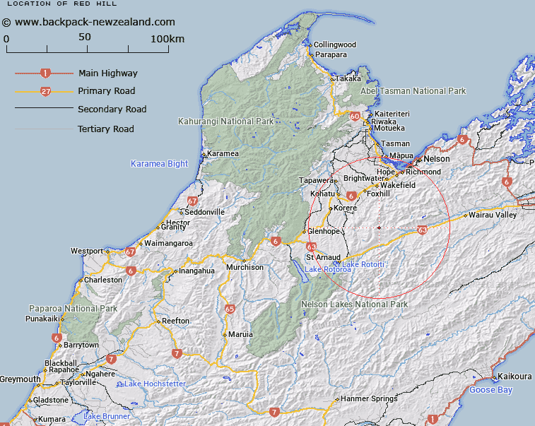
Map showing location of Red Hill
LINZ description: A hill at 1791 m on Red Hills Ridge near the upper reaches of Motueka River Right Branch approximately 26 km northeast of St Arnaud. Feature shown on: NZMS260 N28 Edition 1 1987; NZTopo50-BR25 048917.
Latitude: -41.626722
Longitude: 173.057722
Northing: 5391665.4
Easting: 1604808.3
Land District: Nelson
Feat Type: Hill
Latitude: -41.626722
Longitude: 173.057722
Northing: 5391665.4
Easting: 1604808.3
Land District: Nelson
Feat Type: Hill

Scroll down to see a more detailed road map and below that a topographical map showing the location of Red Hill. The road map has been supplied by openstreetmap and the topographical map of Red Hill has been supplied by Land Information New Zealand (LINZ).
Yes you can use the top static map for you school/university project or personal website with a link back. Contact me for any commercial use.
[ A ] [ B ] [ C ] [ D ] [ E ] [ F ] [ G ] [ H ] [ I ] [ J ] [ K ] [ L ] [ M ] [ N ] [ O ] [ P ] [ Q ] [ R ] [ S ] [ T ] [ U ] [ V ] [ W ] [ X ] [ Y ] [ Z ]