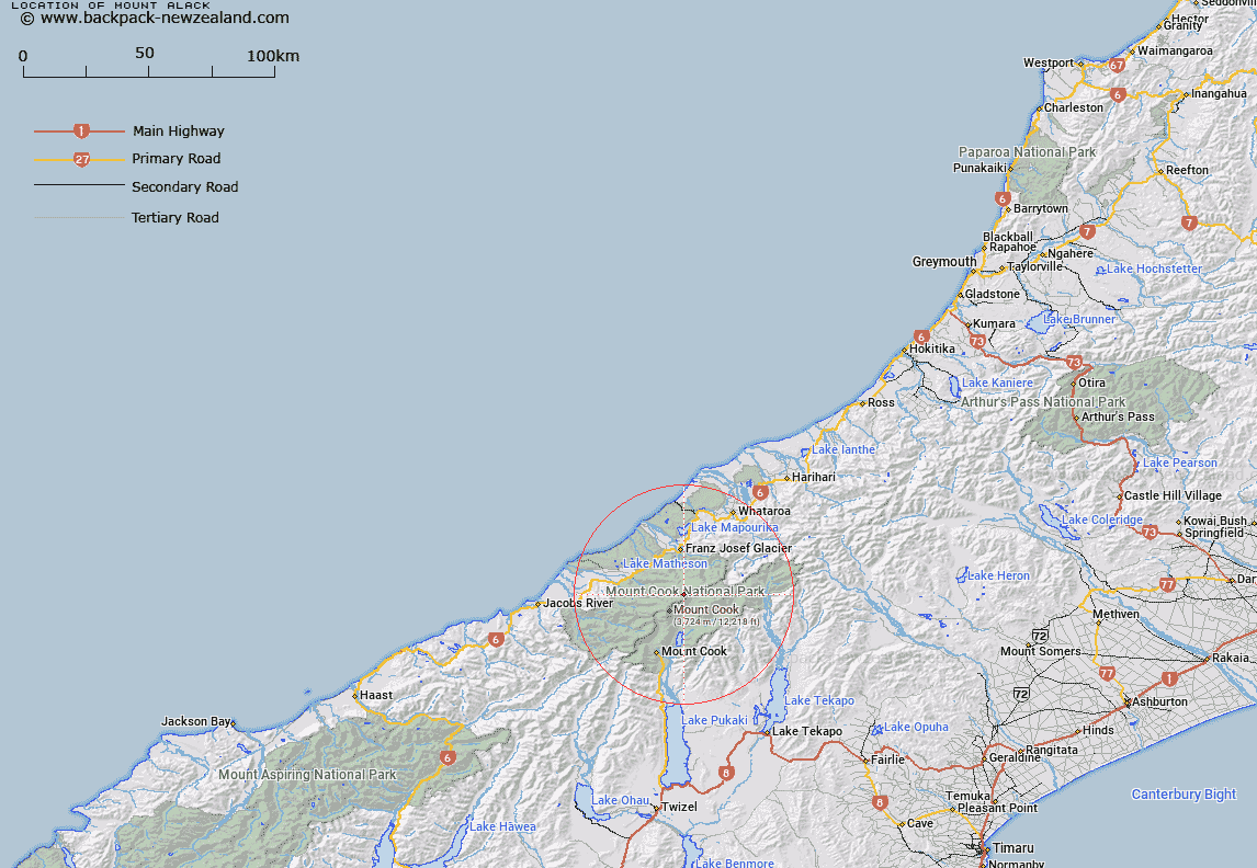
Map showing location of Mount Alack


LINZ description: An offshoot of Pioneer Ridge, near Mount Douglas. Block VII Mount Cook Survey District.
Latitude: -43.539508
Longitude: 170.193701
Northing: 5175444.5
Easting: 1373269.9
Land District: Westland
Feat Type: Hill


Scroll down to see a more detailed road map and below that a topographical map showing the location of Mount Alack. The road map has been supplied by openstreetmap and the topographical map of Mount Alack has been supplied by Land Information New Zealand (LINZ).

Yes you can use the top static map for you school/university project or personal website with a link back. Contact me for any commercial use.

Mount Alack Map New Zealand


New Zealand places in our database
[ A ] [ B ] [ C ] [ D ] [ E ] [ F ] [ G ] [ H ] [ I ] [ J ] [ K ] [ L ] [ M ] [ N ] [ O ] [ P ] [ Q ] [ R ] [ S ] [ T ] [ U ] [ V ] [ W ] [ X ] [ Y ] [ Z ]


Closest 20 Hills to Mount Alack

Douglas Peak ( 0.74km )   Glacier Peak ( 1.29km )   Mount Haidinger ( 1.4km )   Bristol Top ( 1.8km )   Conway Peak ( 1.9km )   Mount Barnicoat ( 1.93km )   Mount Mallory ( 1.94km )   Emas Dome ( 1.99km )   Grey Peak ( 2.08km )   Triad Peak ( 2.22km )   West Hoe ( 2.49km )   Mount Haast ( 2.52km )   Mount Spencer ( 2.79km )   Dixon Peak ( 2.87km )   Mount Christie ( 2.9km )   The Buttress ( 2.93km )   Lendenfeld Peak ( 2.98km )   Mount Halcombe ( 3.19km )   Mount Frederick Gardiner ( 3.19km )   Mount Aurora ( 3.58km )   Mount Von Bulow ( 3.62km )   Mount Tasman ( 4.15km )   Meteor Peak ( 4.19km )   Glacier Dome ( 4.33km )   Torres Peak ( 4.43km )   Bismarck Peaks ( 4.48km )   Mount Jervois ( 4.6km )   Silberhorn ( 4.61km )   Tusk ( 4.9km )   Graham Peak ( 5.12km )   Receveur Peak ( 5.12km )   Le Receveur Peak ( 5.12km )   Big Mac ( 5.25km )   Aigrette ( 5.35km )   Mount Teichelmann ( 5.36km )   Magellan ( 5.44km )   Mount Anderegg ( 5.52km )   Drake ( 5.57km )   Chancellor Dome ( 5.7km )   Malaspina ( 5.82km )