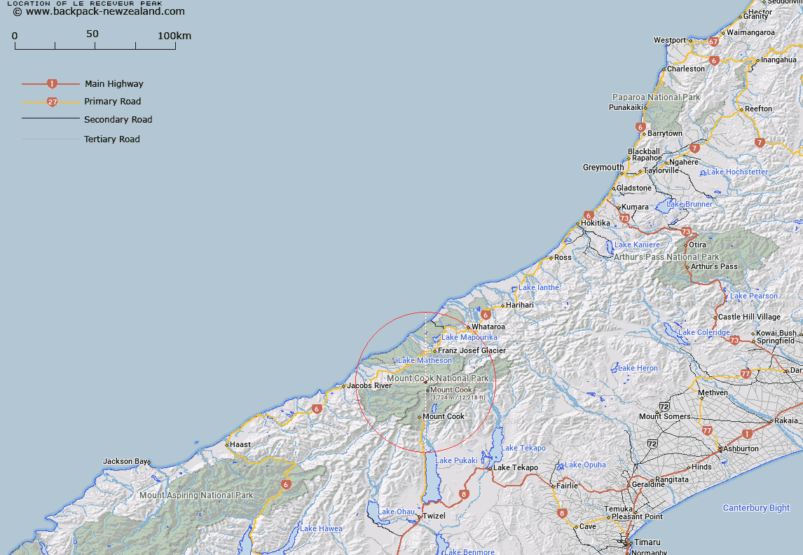
Map showing location of Le Receveur Peak


LINZ description: Peak at height 2609m on the Fox Range, 2.5km north-west of Mount Tasman
Latitude: -43.551211
Longitude: 170.132232
Northing: 5173975.1
Easting: 1368348.3
Land District: Westland
Feat Type: Hill


Scroll down to see a more detailed road map and below that a topographical map showing the location of Le Receveur Peak. The road map has been supplied by openstreetmap and the topographical map of Le Receveur Peak has been supplied by Land Information New Zealand (LINZ).

Yes you can use the top static map for you school/university project or personal website with a link back. Contact me for any commercial use.

Le Receveur Peak Map New Zealand


New Zealand places in our database
[ A ] [ B ] [ C ] [ D ] [ E ] [ F ] [ G ] [ H ] [ I ] [ J ] [ K ] [ L ] [ M ] [ N ] [ O ] [ P ] [ Q ] [ R ] [ S ] [ T ] [ U ] [ V ] [ W ] [ X ] [ Y ] [ Z ]


Closest 20 Hills to Le Receveur Peak

Big Mac ( 0.54km )   Torres Peak ( 1.48km )   Vanguard ( 2.1km )   Drake ( 2.11km )   Mount Du Fresne ( 2.25km )   The Buttress ( 2.26km )   Magellan ( 2.33km )   Mount Tasman ( 2.58km )   Mount Teichelmann ( 2.75km )   Graham Peak ( 2.86km )   Silberhorn ( 3.06km )   Lendenfeld Peak ( 3.16km )   Malaspina ( 3.19km )   Belmont ( 3.2km )   Crozet Peak ( 3.38km )   Mount Haast ( 3.77km )   Vancouver Mountain ( 3.85km )   Storm ( 4.02km )   Mount Hicks (Saint Davids Dome) ( 4.06km )   Mount Garnier ( 4.12km )   Dixon Peak ( 4.18km )   Mount Dampier ( 4.3km )   Sturdee Peak ( 4.45km )   Beatty Peak ( 4.45km )   Grey Peak ( 4.49km )   Chancellor Dome ( 4.57km )   High Peak ( 4.94km )   North Peak ( 4.94km )   Aoraki/Mount Cook ( 4.97km )   Mount Cook ( 4.97km )   Mount Alack ( 5.12km )   Jellicoe Peak ( 5.19km )   Glacier Dome ( 5.38km )   Mount Haidinger ( 5.43km )   Lowe Mountain ( 5.64km )   Low Mountain ( 5.64km )   Sam Peak ( 5.69km )   Douglas Peak ( 5.75km )   Middle Peak ( 5.86km )   West Hoe ( 6.26km )