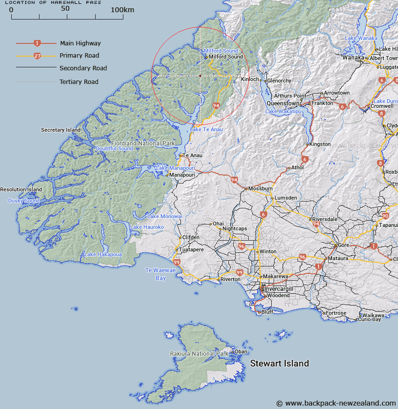
Map showing location of Marshall Pass


LINZ description: A double saddle between Iceberg Lake, a Lake on the north branch of the Clinton River and Joes River.
Latitude: -44.811422
Longitude: 167.874799
Northing: 5025205.8
Easting: 1194729.1
Land District: Southland
Feat Type: Pass


Scroll down to see a more detailed road map and below that a topographical map showing the location of Marshall Pass. The road map has been supplied by openstreetmap and the topographical map of Marshall Pass has been supplied by Land Information New Zealand (LINZ).

Yes you can use the top static map for you school/university project or personal website with a link back. Contact me for any commercial use.

Marshall Pass Map New Zealand


New Zealand places in our database
[ A ] [ B ] [ C ] [ D ] [ E ] [ F ] [ G ] [ H ] [ I ] [ J ] [ K ] [ L ] [ M ] [ N ] [ O ] [ P ] [ Q ] [ R ] [ S ] [ T ] [ U ] [ V ] [ W ] [ X ] [ Y ] [ Z ]


Closest 20 Passs to Marshall Pass

Mackinnon Pass ( 9.45km )   Homer's Saddle ( 10.1km )   Homer Saddle ( 10.1km )   Lyttles Dip ( 10.48km )   Grave-Talbot Pass ( 11.62km )   Traverse Pass ( 11.75km )   U Pass ( 11.99km )   Glade Pass ( 12.21km )   Gertrude Saddle ( 13.24km )   Hunter Pass ( 14.57km )   Adelaide Saddle ( 14.81km )   Dore Pass ( 15.98km )   Darran Pass ( 16.31km )   Birley Pass ( 17.52km )   The Divide ( 19.26km )   Robb Saddle ( 19.87km )   Worsley Pass ( 19.92km )   Crampon Pass ( 20.05km )   Greenstone Saddle ( 21.05km )   Pakihaukea Pass ( 22.39km )   McKellar Saddle ( 22.43km )   Bowen Col ( 25.24km )   Turner Pass ( 26.07km )   Oilskin Pass ( 26.46km )   Emily Pass ( 27.01km )   Edith Saddle ( 28.1km )   Ngapunatoru Pass ( 28.59km )   Serpentine Saddle ( 28.96km )   North Col ( 30.87km )   Little Homer Saddle ( 31.5km )   Catseye Saddle ( 33.98km )   Sugarloaf Pass ( 34.09km )   Harrison Saddle ( 35.14km )   O'Leary Pass ( 35.33km )   Park Pass ( 35.52km )   Henry Pass ( 36.88km )   Cow Saddle ( 38.97km )   Fiery Col ( 40.94km )   Valpys Pass ( 41.48km )   Alabaster Pass ( 42.09km )