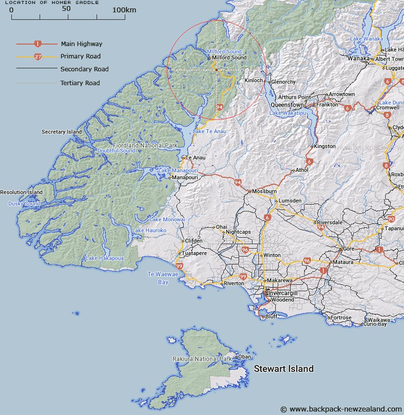
Map showing location of Homer Saddle


LINZ description: Saddle in Hollyford Survey District about four miles south of Lake Alabaster
Latitude: -44.75931
Longitude: 167.979626
Northing: 5031513.4
Easting: 1202660.1
Land District: Southland
Feat Type: Pass


Scroll down to see a more detailed road map and below that a topographical map showing the location of Homer Saddle. The road map has been supplied by openstreetmap and the topographical map of Homer Saddle has been supplied by Land Information New Zealand (LINZ).

Yes you can use the top static map for you school/university project or personal website with a link back. Contact me for any commercial use.

Homer Saddle Map New Zealand


New Zealand places in our database
[ A ] [ B ] [ C ] [ D ] [ E ] [ F ] [ G ] [ H ] [ I ] [ J ] [ K ] [ L ] [ M ] [ N ] [ O ] [ P ] [ Q ] [ R ] [ S ] [ T ] [ U ] [ V ] [ W ] [ X ] [ Y ] [ Z ]


Closest 20 Passs to Homer Saddle

Lyttles Dip ( 1.62km )   Traverse Pass ( 1.71km )   Grave-Talbot Pass ( 2.53km )   Gertrude Saddle ( 3.14km )   Adelaide Saddle ( 4.79km )   Darran Pass ( 6.54km )   Marshall Pass ( 10.1km )   Crampon Pass ( 10.32km )   U Pass ( 12.46km )   The Divide ( 13.17km )   Pakihaukea Pass ( 13.77km )   Greenstone Saddle ( 14.81km )   Glade Pass ( 14.98km )   McKellar Saddle ( 17.11km )   Turner Pass ( 17.58km )   Emily Pass ( 17.71km )   Mackinnon Pass ( 18.33km )   Serpentine Saddle ( 18.89km )   Bowen Col ( 19.33km )   Dore Pass ( 20km )   North Col ( 20.78km )   Ngapunatoru Pass ( 21.39km )   Birley Pass ( 21.59km )   Little Homer Saddle ( 21.9km )   Sugarloaf Pass ( 24.3km )   Hunter Pass ( 24.55km )   Park Pass ( 25.5km )   O'Leary Pass ( 27.88km )   Cow Saddle ( 29.19km )   Robb Saddle ( 29.68km )   Worsley Pass ( 30.01km )   Fiery Col ( 31.13km )   Valpys Pass ( 31.48km )   Alabaster Pass ( 32.5km )   Fohn Saddle ( 34.13km )   Oilskin Pass ( 36.55km )   Lennox Pass ( 37.46km )   Wright Pass ( 37.61km )   Shepherds Pass ( 38.01km )   Luncheon Col ( 38.05km )