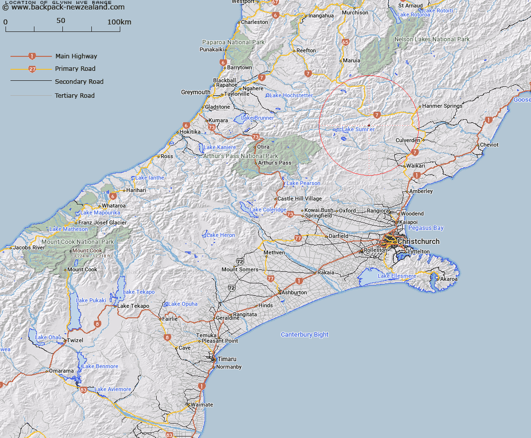
Map showing location of Glynn Wye Range
LINZ description: Mountain range commencing at Mount Longfellow [Trig. V (Geodetic Code A8HY)], and extending generally easterly through Mounts Pan [Trig. P (Geodetic Code A8HL)], and Skiddaw [Trig. Q (Geodetic Code A8HN)], to La Grippe Peak [Trig. S (Geodetic Code B28K)], on the Organ Range. Blocks I and IV Mytholm, and Blocks XIII, XIV, XV and XVI Skiddaw Survey Districts.
Latitude: -42.665927
Longitude: 172.439797
Northing: 5276130.3
Easting: 1554092.1
Land District: Canterbury
Feat Type: Range
Latitude: -42.665927
Longitude: 172.439797
Northing: 5276130.3
Easting: 1554092.1
Land District: Canterbury
Feat Type: Range

Scroll down to see a more detailed road map and below that a topographical map showing the location of Glynn Wye Range. The road map has been supplied by openstreetmap and the topographical map of Glynn Wye Range has been supplied by Land Information New Zealand (LINZ).
Yes you can use the top static map for you school/university project or personal website with a link back. Contact me for any commercial use.
[ A ] [ B ] [ C ] [ D ] [ E ] [ F ] [ G ] [ H ] [ I ] [ J ] [ K ] [ L ] [ M ] [ N ] [ O ] [ P ] [ Q ] [ R ] [ S ] [ T ] [ U ] [ V ] [ W ] [ X ] [ Y ] [ Z ]