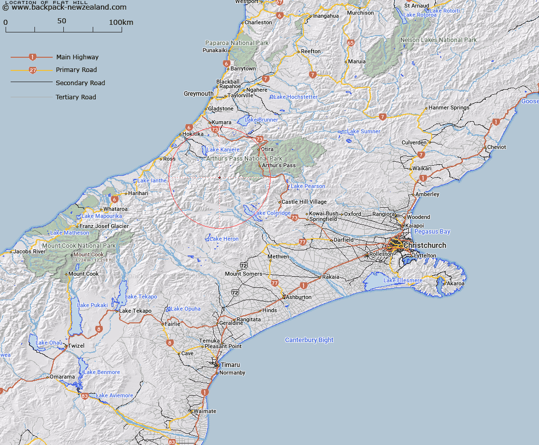
Map showing location of Flat Hill


LINZ description: Peak approximately 2.4km North-east of Mount Eliot, above the Right Bank of Griffiths Stream. Block I Wilberforce Survey District.
Latitude: -43.029353
Longitude: 171.262215
Northing: 5234460.3
Easting: 1458422
Land District: Canterbury
Feat Type: Hill


Scroll down to see a more detailed road map and below that a topographical map showing the location of Flat Hill. The road map has been supplied by openstreetmap and the topographical map of Flat Hill has been supplied by Land Information New Zealand (LINZ).

Yes you can use the top static map for you school/university project or personal website with a link back. Contact me for any commercial use.

Flat Hill Map New Zealand


New Zealand places in our database
[ A ] [ B ] [ C ] [ D ] [ E ] [ F ] [ G ] [ H ] [ I ] [ J ] [ K ] [ L ] [ M ] [ N ] [ O ] [ P ] [ Q ] [ R ] [ S ] [ T ] [ U ] [ V ] [ W ] [ X ] [ Y ] [ Z ]


Closest 20 Hills to Flat Hill

Mount Eliot ( 2.42km )   Mount Eliott ( 2.42km )   Mount Ethel ( 3.43km )   Mount Ambrose ( 3.64km )   Commodore Peak ( 3.79km )   Mount Cabot ( 3.96km )   Mount Park ( 4.15km )   Mount Scott ( 4.6km )   Mungo Peak ( 4.65km )   The Rampart ( 5.17km )   Mount Treadwell ( 5.23km )   Mount Fitzgerald ( 5.26km )   Mount Findlay ( 5.33km )   Mount Camsell ( 5.39km )   Sebastopol ( 5.47km )   Mount Griffiths ( 5.64km )   Bastion Ridge ( 6.06km )   Mount Keddell ( 6.53km )   Mount Chamberlin ( 6.85km )   Mount Chamberlain ( 6.85km )   Mount Bannatyne ( 6.98km )   Lilian Mount ( 6.99km )   Mystery Peak ( 7.19km )   Mount Bryce ( 7.32km )   Mount Collet ( 7.39km )   Mount Kai Iwi ( 7.39km )   Five Jagged Peaks ( 7.4km )   Mount Walter ( 7.66km )   Mount Harrison ( 8.11km )   Mount Learmont ( 8.35km )   Moa Hill ( 8.48km )   Shafto Peak ( 8.66km )   Mount Kensington ( 9.09km )   Mount Reeves ( 9.32km )   Mount Ballance ( 9.42km )   Mount Murchison ( 9.74km )   Mount Stout ( 9.83km )   Mount Beals ( 10.05km )   Mount Wakeman ( 10.2km )   Mount Notman ( 10.38km )