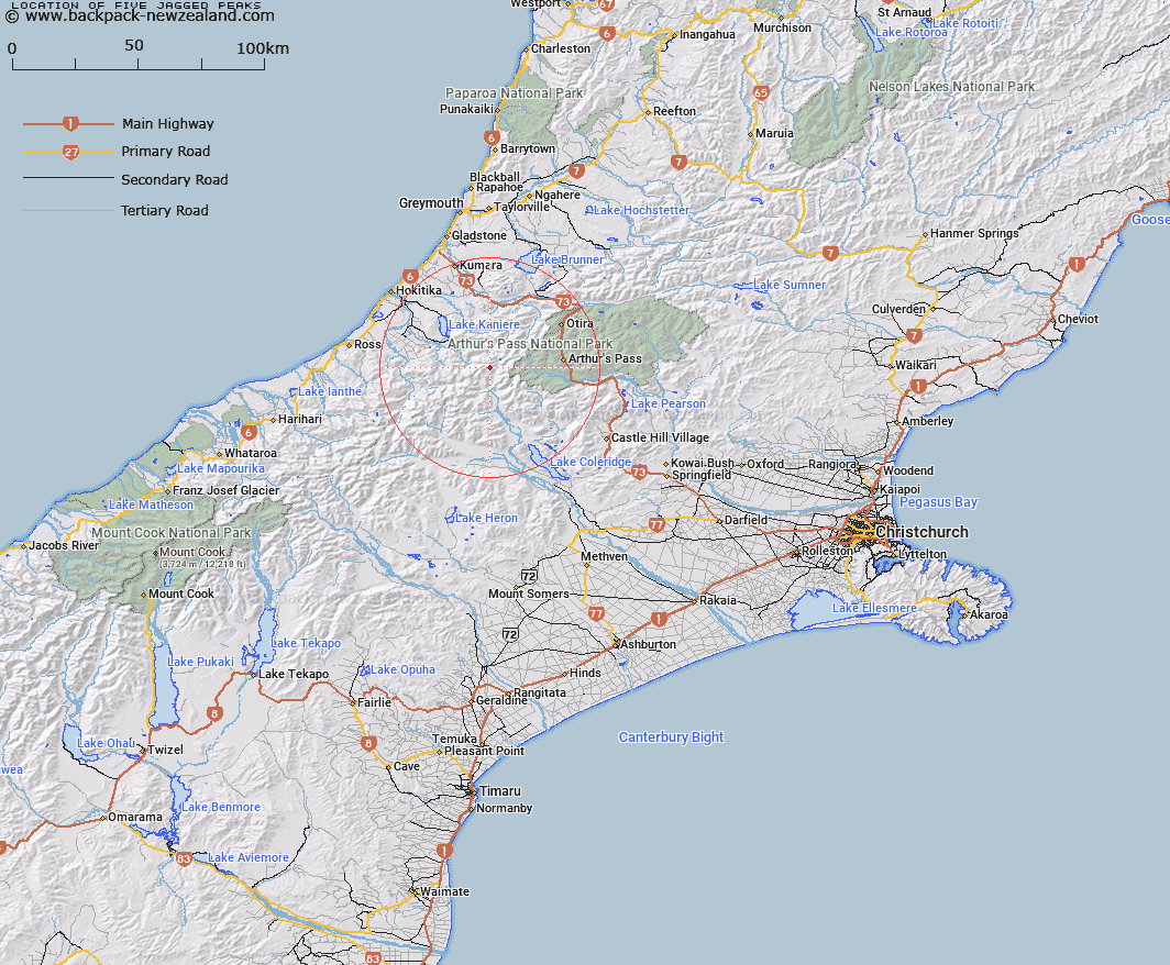
Map showing location of Five Jagged Peaks


LINZ description: Peaks on Reeses Ridge between Mount Walter and Mount Lillian, above Gifford Stream. Davie Survey District.
Latitude: -42.972177
Longitude: 171.308812
Northing: 5240887.3
Easting: 1462090.4
Land District: Canterbury
Feat Type: Hill


Scroll down to see a more detailed road map and below that a topographical map showing the location of Five Jagged Peaks. The road map has been supplied by openstreetmap and the topographical map of Five Jagged Peaks has been supplied by Land Information New Zealand (LINZ).

Yes you can use the top static map for you school/university project or personal website with a link back. Contact me for any commercial use.

Five Jagged Peaks Map New Zealand


New Zealand places in our database
[ A ] [ B ] [ C ] [ D ] [ E ] [ F ] [ G ] [ H ] [ I ] [ J ] [ K ] [ L ] [ M ] [ N ] [ O ] [ P ] [ Q ] [ R ] [ S ] [ T ] [ U ] [ V ] [ W ] [ X ] [ Y ] [ Z ]


Closest 20 Hills to Five Jagged Peaks

Mount Walter ( 0.36km )   Lilian Mount ( 0.42km )   Mount Learmont ( 1.85km )   Mount Keddell ( 2.12km )   Mount Camsell ( 2.5km )   Mount Beals ( 2.78km )   Mount Griffiths ( 2.97km )   Mount Scott ( 3km )   Mount Fitzgerald ( 3.54km )   Mount Cabot ( 3.57km )   Twin Peaks ( 3.68km )   Mount McDonald ( 4.07km )   Mount Ethel ( 4.18km )   Mount Harman/Kaniere ( 5.99km )   Mount Harman ( 5.99km )   Mount Lathrop ( 6.05km )   Commodore Peak ( 6.21km )   Mount Pope ( 6.32km )   Mount Wakeman ( 6.46km )   Mount Murchison ( 6.58km )   Mount Marianne ( 6.63km )   Mount Marion ( 6.63km )   Mount Browning ( 6.68km )   Mount Davie ( 6.91km )   Mount Ambrose ( 7.03km )   Mount Axis ( 7.04km )   Flat Hill ( 7.4km )   Mount Rosamond ( 7.5km )   Cairn Peak ( 7.55km )   Mount Isobel ( 7.91km )   Tyndalls Knob ( 7.91km )   Sebastopol ( 8.15km )   Mount Harper ( 8.76km )   The Rampart ( 8.79km )   Bastion Ridge ( 9.29km )   Mount Speight ( 9.43km )   Mount Eliott ( 9.48km )   Mount Eliot ( 9.48km )   Mount Greenlaw ( 10.13km )   Mount Reeves ( 10.2km )