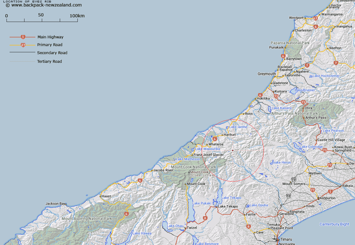
Map showing location of Eves Rib


LINZ description: Ridge near the source of Perth River from the Garden of Eden Ice Plateau, immediately East of Eve Icefall. Block VIII Tyndall Survey District.
Latitude: -43.333144
Longitude: 170.684463
Northing: 5199585.3
Easting: 1412284.2
Land District: Westland
Feat Type: Ridge


Scroll down to see a more detailed road map and below that a topographical map showing the location of Eves Rib. The road map has been supplied by openstreetmap and the topographical map of Eves Rib has been supplied by Land Information New Zealand (LINZ).

Yes you can use the top static map for you school/university project or personal website with a link back. Contact me for any commercial use.

Eves Rib Map New Zealand


New Zealand places in our database
[ A ] [ B ] [ C ] [ D ] [ E ] [ F ] [ G ] [ H ] [ I ] [ J ] [ K ] [ L ] [ M ] [ N ] [ O ] [ P ] [ Q ] [ R ] [ S ] [ T ] [ U ] [ V ] [ W ] [ X ] [ Y ] [ Z ]


Closest 20 Ridges to Eves Rib

Devils Backbone ( 4.18km )   John Pascoe Ridge ( 4.49km )   Harold Spur ( 13.47km )   Murphy Spur ( 14.4km )   Peter Spur ( 14.85km )   Griffen Spur ( 16.31km )   Chink Ridge ( 16.32km )   Slippery Brae ( 16.91km )   Kea Spur ( 17.27km )   Terra Quinn ( 17.72km )   Carls Ridge ( 18.18km )   Carl Spur ( 18.55km )   Crumbling Spur ( 18.57km )   Little Spur ( 19.66km )   Notch Ridge ( 20.04km )   Whirlwind Spur ( 20.51km )   Karnbach ( 20.76km )   Karnback ( 20.76km )   Scramble Spur ( 20.85km )   Big Spur ( 21.98km )   Rocky Ridge ( 22.81km )   Headlong Spur ( 22.83km )   Clearview Spur ( 23.74km )   Alma Spur ( 24.57km )   Gunn Ridge ( 25.21km )   Harker Spur ( 26.75km )   Mazda Spur ( 27.44km )   Katzenbach Ridge ( 27.74km )   Swandri Spur ( 29.87km )   Sawtooth Ridge ( 30.04km )   Dickie Ridge ( 30.89km )   Dickie Spur ( 30.89km )   Pahlow Ridge ( 31.36km )   Galena Ridge ( 34.02km )   Burton Range ( 34.05km )   Burton Ridge ( 34.05km )   Cole Spur ( 34.61km )   Steadman Brow ( 34.94km )   Crooked Spur ( 35km )   Ranger Spur ( 36.5km )