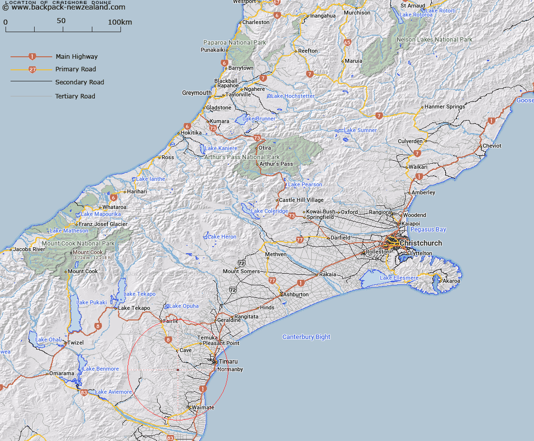
Map showing location of Craigmore Downs


LINZ description: Name to be deleted as part of Maungati locality
Latitude: -44.453889
Longitude: 170.96
Northing: 5075688.7
Easting: 1437696.1
Land District: Canterbury
Feat Type: Locality


Scroll down to see a more detailed road map and below that a topographical map showing the location of Craigmore Downs. The road map has been supplied by openstreetmap and the topographical map of Craigmore Downs has been supplied by Land Information New Zealand (LINZ).

Yes you can use the top static map for you school/university project or personal website with a link back. Contact me for any commercial use.

Craigmore Downs Map New Zealand


New Zealand places in our database
[ A ] [ B ] [ C ] [ D ] [ E ] [ F ] [ G ] [ H ] [ I ] [ J ] [ K ] [ L ] [ M ] [ N ] [ O ] [ P ] [ Q ] [ R ] [ S ] [ T ] [ U ] [ V ] [ W ] [ X ] [ Y ] [ Z ]


Closest 20 Localitys to Craigmore Downs

Maungati ( 0.11km )   Riverview ( 1.67km )   Gordons Valley ( 6.14km )   Bluecliffs ( 6.4km )   Blue Cliffs ( 6.4km )   Motukaika ( 6.71km )   Otaio Gorge ( 8km )   Cannington ( 10.64km )   Southburn ( 11.44km )   Lyalldale ( 12.3km )   Esk Valley ( 12.55km )   Kohika ( 12.75km )   Pareora West ( 13.25km )   Claremont ( 14.47km )   Taiko ( 15.16km )   Cave ( 15.72km )   Otipua ( 15.98km )   Adair ( 17.36km )   Springbrook ( 17.92km )   Hadlow ( 18.76km )   Monavale ( 19.34km )   Fairview ( 19.34km )   Hunter ( 19.47km )   Levels Valley ( 19.55km )   Sutherlands ( 20.03km )   Pareora ( 20.13km )   Saint Andrews ( 20.16km )   Mawaro ( 20.32km )   Salisbury ( 20.47km )   Rosewill ( 20.64km )   Kingsdown ( 20.84km )   Otaio ( 21.07km )   Redruth ( 22.31km )   Normanby ( 22.39km )   Cattle Creek ( 23.45km )   Scarborough ( 23.66km )   Makikihi ( 24.44km )   Totara Valley ( 24.56km )   Smithfield ( 24.82km )   Levels ( 24.95km )