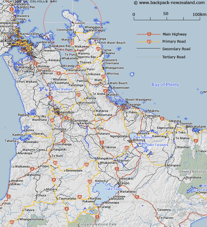
Map showing location of Colville Bay


LINZ description: The bay immediately south of Tokawhero Point and near Colville, Coromandel Peninsula
Latitude: -36.622295
Longitude: 175.463593
Northing: 5944200
Easting: 1820300
Land District: South Auckland
Feat Type: Bay


Scroll down to see a more detailed road map and below that a topographical map showing the location of Colville Bay. The road map has been supplied by openstreetmap and the topographical map of Colville Bay has been supplied by Land Information New Zealand (LINZ).

Yes you can use the top static map for you school/university project or personal website with a link back. Contact me for any commercial use.

Colville Bay Map New Zealand


New Zealand places in our database
[ A ] [ B ] [ C ] [ D ] [ E ] [ F ] [ G ] [ H ] [ I ] [ J ] [ K ] [ L ] [ M ] [ N ] [ O ] [ P ] [ Q ] [ R ] [ S ] [ T ] [ U ] [ V ] [ W ] [ X ] [ Y ] [ Z ]


Closest 20 Bays to Colville Bay

Whangaahei Bay ( 0.9km )   Otautu Bay ( 2.49km )   Tukituki Bay ( 3.6km )   Waitete Bay ( 5.02km )   Waikawau Bay ( 6.48km )   Little Bay ( 7.72km )   Te Karaka Bay ( 7.97km )   Potiki Bay ( 9.03km )   Taiharuru Bay ( 9.14km )   Elephant Cove ( 9.81km )   Pohatuwhakairi Bay ( 9.87km )   Te Kapoai Bay ( 10.5km )   Rauporoa Bay ( 10.59km )   Sandy Bay ( 10.85km )   Kennedy Bay ( 10.94km )   Ngohitanu Bay ( 11.11km )   Carey Bay ( 11.51km )   Koputauaki Bay ( 11.55km )   Port Charles ( 11.71km )   Oahuru Bay ( 11.75km )   Oakura Bay ( 11.75km )   Golden Bay ( 12.25km )   Oamaru Bay ( 12.38km )   Stony Bay ( 13.11km )   Tucks Bay ( 13.46km )   Rowner Bay ( 13.54km )   Long Bay ( 13.95km )   Shag Bay ( 14.07km )   Wainuiototo Bay ( 15.12km )   McGregor Bay ( 15.26km )   Wyuna Bay ( 15.5km )   Poley Bay ( 15.97km )   Makariri Bay ( 16.35km )   Fantail Bay ( 16.84km )   Aropawa Bay ( 17.01km )   Goat Bay ( 17.63km )   Brickfield Bay ( 17.66km )   Fletcher Bay ( 17.66km )   Woolshed Bay ( 18.38km )   Port Jackson ( 19.85km )