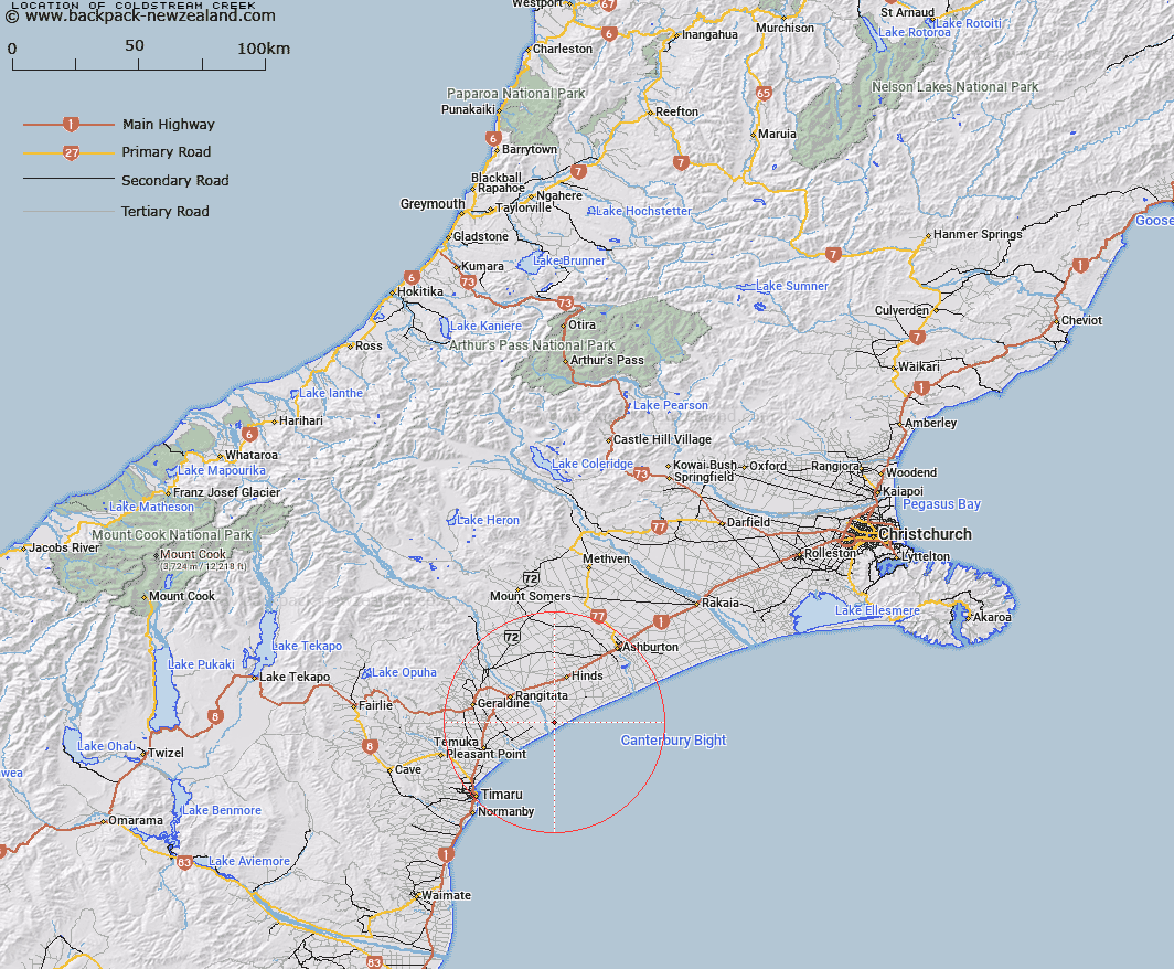
Map showing location of Coldstream Creek


LINZ description: A small stream, 5km long, flowing south-easterly into Canterbury Bight, located on the left bank of the Rangitata River and 20km north-east of Temuka. NZTopo50 BZ20-Clandeboye, from source GR 808 115 to sea GR 836 083 (NZTM2000: 5108300 N 1483600 E; NZGD2000: 44 10 09 S 171 32 38 E).
Latitude: -44.150545
Longitude: 171.529347
Northing: 5110354.8
Easting: 1482389.9
Land District: Canterbury
Feat Type: Stream


Scroll down to see a more detailed road map and below that a topographical map showing the location of Coldstream Creek. The road map has been supplied by openstreetmap and the topographical map of Coldstream Creek has been supplied by Land Information New Zealand (LINZ).

Yes you can use the top static map for you school/university project or personal website with a link back. Contact me for any commercial use.

Coldstream Creek Map New Zealand


New Zealand places in our database
[ A ] [ B ] [ C ] [ D ] [ E ] [ F ] [ G ] [ H ] [ I ] [ J ] [ K ] [ L ] [ M ] [ N ] [ O ] [ P ] [ Q ] [ R ] [ S ] [ T ] [ U ] [ V ] [ W ] [ X ] [ Y ] [ Z ]


Closest 20 Streams to Coldstream Creek

Kapunatiki Creek ( 7.92km )   Rangitata River Middle Channel ( 8.48km )   Rangitata River South Channel ( 8.82km )   Rhodes Stream ( 13.23km )   Ohapi Creek ( 17.67km )   Harakeke Tautoro Island ( 18.98km )   Ohapi Creek South Branch ( 19.29km )   Orakipaoa Creek ( 20.23km )   Dobies Stream ( 20.97km )   Downs Creek ( 22.62km )   Temuka River ( 22.79km )   Waihi River ( 24.48km )   Raupo Creek ( 26.48km )   Waiakeake Stream ( 27.09km )   Rangatira Creek ( 27.11km )   Hae Hae Te Moana River ( 29.47km )   Carters Creek ( 30.09km )   Brooks Creek ( 30.15km )   Ashburton River/Hakatere ( 30.22km )   Ashburton River ( 30.22km )   Coopers Creek ( 30.88km )   Connells Creek ( 31.3km )   Pleasant Point Stream ( 32.8km )   Waitawa Creek ( 32.83km )   Selby Stream ( 32.91km )   North Branch Ashburton River ( 33.28km )   North Branch Ashburton River/Hakatere ( 33.28km )   Scotsburn Stream ( 33.57km )   Lagmhor Creek ( 33.83km )   Kakahu River ( 34.02km )   McLeod Stream ( 34.08km )   Washdyke Creek ( 34.44km )   Station Stream ( 34.63km )   Kowhai Stream ( 34.64km )   Kowai Stream ( 34.64km )   Orari River ( 34.71km )   Mills Stream ( 34.72km )   Wakanui Creek ( 34.72km )   Taitarakihi Creek ( 35.08km )   Slip Panel Stream ( 35.13km )