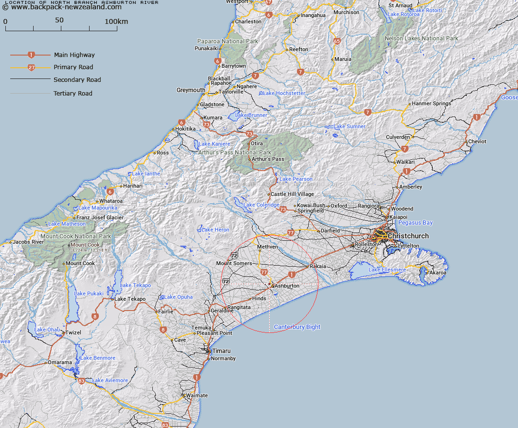
Map showing location of North Branch Ashburton River


LINZ description: Feature shown on: NZMS260-K37 075017; NZTopo50-BY21 975400;
Latitude: -43.885977
Longitude: 171.723978
Northing: 5140000
Easting: 1497500
Land District: Canterbury
Feat Type: Stream


Scroll down to see a more detailed road map and below that a topographical map showing the location of North Branch Ashburton River. The road map has been supplied by openstreetmap and the topographical map of North Branch Ashburton River has been supplied by Land Information New Zealand (LINZ).

Yes you can use the top static map for you school/university project or personal website with a link back. Contact me for any commercial use.

North Branch Ashburton River Map New Zealand


New Zealand places in our database
[ A ] [ B ] [ C ] [ D ] [ E ] [ F ] [ G ] [ H ] [ I ] [ J ] [ K ] [ L ] [ M ] [ N ] [ O ] [ P ] [ Q ] [ R ] [ S ] [ T ] [ U ] [ V ] [ W ] [ X ] [ Y ] [ Z ]


Closest 20 Streams to North Branch Ashburton River

North Branch Ashburton River/Hakatere ( 0km )   North Branch Ashburton River ( 0km )   Wakanui Creek ( 1.74km )   Carters Creek ( 4.1km )   Lagmhor Creek ( 5.14km )   Brooks Creek ( 5.88km )   Ashburton River ( 9.16km )   Ashburton River/Hakatere ( 9.16km )   Remington Creek ( 9.42km )   Harding Creek ( 14.41km )   O'Shea Creek ( 18.55km )   Hinds River ( 23.91km )   Rangitata Diversion Race ( 31.4km )   Buccleuch Stream ( 32.57km )   South Branch Ashburton River/Hakatere ( 32.71km )   South Branch Ashburton River ( 32.71km )   Buccleugh Stream ( 33.25km )   Coldstream Creek ( 33.28km )   Surrey Stream ( 33.3km )   Furze Stream ( 33.35km )   Dry Creek ( 34.54km )   The Mill Creek ( 34.78km )   Rangitata River Middle Channel ( 34.88km )   Rangitata River South Channel ( 35.51km )   Gawler Stream ( 36km )   Caves Stream ( 36.14km )   Flynn Stream ( 36.3km )   Hinds River North Branch ( 36.36km )   Mills Stream ( 36.55km )   Stevenson Stream ( 36.78km )   Reid Stream ( 37.06km )   Coopers Creek ( 37.69km )   Staveley Stream ( 38.15km )   Kowhai Stream ( 38.39km )   Kowai Stream ( 38.39km )   Limestone Creek ( 38.9km )   Tinstone Creek ( 39.15km )   Stony Creek ( 39.18km )   Kapunatiki Creek ( 39.21km )   Picnic Creek ( 39.25km )